 |
Riding an ATV in Ontario By Bill "BillaVista" Ansell |
IntroductionThis article is intended to be a gathering of information on ATV Associations, Federations, Clubs, Trails, Laws, Maps, and GPS files for Ontario, Canada. It is organized into several sections, as follows: Section 1 - Rules and Regulations.Might as well get the legal stuff out of the way first. This section includes links to the full and complete legal texts of the laws governing the use of ATVs in Ontario, along with plain English text summaries of the most important points. |
 |
Section 2 - The Big Three.An introduction to the main three organizations that govern ATV riding in Ontario. Section 3 - The Big Map.A large-scale map of Ontario showing the rough location of ATV trails in Ontario. For situational awareness only - not for navigation or plotting. Section 4 - Clubs & Trails.Generally, each trail or trail-riding area is governed / administrated / taken care of by an ATV club. This section list the clubs (grouped by the association to which they belong) and provides where possible maps, data, descriptions, GPS files, and any special regulations governing their use. Section 5 - Municipal By-Laws.A gathering of all the data I have been able to collect on specific municipal By-Laws governing on-road ATV use in various Ontario municipalities. Section 6 - Other Organizations.A listing and brief descriptions, along with links, to other organizations that are related to or impact ATV riding. |
|
Section 1 - Rules and RegulationsThe LawsATV use in Ontario is governed by the following federal and provincial laws:
Official GuidelinesMost of the above documents are written in formal legal language which can be difficult to read and understand. As such, the following provincial organizations have published common-language summaries of much of the information. Note, however, that these summaries are often caveated with statements such as: "This is only a guide. For more detailed information on legal requirements for ATV use, please refer to the Off-Road Vehicles Act (ORVA) and the Highway Traffic Act (HTA)". That's why the full legal documents are linked above. Ontario Ministry of Transportation
Ontario Provincial Police
Ottawa Police Service
Rules & Regulations CompilationThe following is a compilation of information from the above links. Of course, this is only a guide. For more detailed information on legal requirements for ATV use, please refer to the Off-Road Vehicles Act (ORVA) and the Highway Traffic Act (HTA) DEFINITIONSORV (Off-Road Vehicle) - a vehicle propelled or driven otherwise than by muscular power or wind and designed to travel:
Peace Officer - “peace officer” includes a police officer, conservation officer or other person employed for the preservation and maintenance of the public peace or any officer appointed for enforcing or carrying out the provisions of the Off-Road Vehicles Act. Conservation Officer - “conservation officer” means a conservation officer under the Fish and Wildlife Conservation Act, 1997 and an officer under the Provincial Parks and Conservation Reserves Act, 2006; Occupier (of land) - “occupier” includes:
Highway - “highway”, includes a common and public highway, street, avenue, parkway, driveway, square, place, bridge, viaduct or trestle, any part of which is intended for or used by the general public for the passage of vehicles and includes the area between the lateral property lines thereof. ATV USE OFF-ROADREGISTRATION
AGE LIMIT FOR DRIVING
INSURANCE
LIABILITY
RULES WHEN DRIVING
ATV USE ON-ROADATV use on roads is governed by the Highway Traffic Act, the Ontario Regulation 316/03 made under the Highway Traffic Act, and applicable municipal by-laws. In addition to the rules for ATV USE OFF-ROAD described above, the following additional rules govern ATV use on-road: ATV EQUIPMENT REQUIREMENTS Motor vehicle safety standards The ATV must meet the motor vehicle safety standards prescribed for restricted-use motorcycles in the Motor Vehicle Safety Regulations made under the Motor Vehicle Safety Act (Canada) applicable when the vehicle was manufactured. Note: After a pretty thorough look through the Motor Vehicle Safety Regulations I could find only one occurrence of anything that looked like a "motor vehicle safety standards prescribed for restricted-use motorcycles", and that was paragraph 108 (2) on page 109 that states:
TSD 108 refers to "Technical Standards Document No. 108, Lamps, Reflective Devices and Associated Equipment". This I found strange, because the requirement written above comes from Section 9 of Ontario Regulation 316/03 made under the Highway Traffic Act, which then goes on in section 13 to explicitly describe the requirement for lamps and reflectors om ATVs that are to be operated on-road. I can only surmise that this broad requirement for conformation to the safety standards prescribed for restricted-use motorcycles in the Motor Vehicle Safety Regulations is there in case any such requirements are added in future? I really don't know. Equipment configuration and performance requirements
ATV ON-ROAD OPERATION REQUIREMENTS
PERMITTED AND PROHIBITED ROADS AND HIGHWAYS ATV use on-road in Ontario falls into one of two categories - use on provincial highways or use on local municipal roads. Provincial Highways Regulation 316/03 grants ATVs access to the shoulder and paved portions of some Ontario provincial highways, as follows.
Regulation 316/03 gives individual municipalities the authority to determine whether or not ATVs should be allowed access to roads under their authority. Municipalities must put a by-law in place for ATVs to be allowed access to their roads. Municipalities can determine which roads, where on the road, time of day, and season that ATVs are allowed access. They can also set speed limits that are lower than those set out in the regulation. If a by-law does not exist, ATVs are not allowed access to that municipality's roads. The intent of the regulation is to allow ATV clubs to link trails and provide ATV riders access to important amenities such as fuel, lodging, repairs and restaurants. Individual municipalities and their by-laws allowing ATV use on roads in their jurisdiction will be listed later in this article under section 5. ENFORCEMENTWhen riding an ATV along a roadway, on a trail system, or on Crown land, the requirements of the Highway Traffic Act and/or the Off-Road Vehicles Act are enforced by police and conservation officers across the province. If you are stopped by a police or conservation officer when riding an ATV while not on the vehicle owner’s land, you must produce the following information and documents when requested:
PRIVATE PROPERTYATVs that are driven on the vehicle owner’s land are exempt from certain requirements, as follows:
Note that:
ALCOHOLIt is against the law to drive an ATV anywhere, anytime when impaired by alcohol or drugs. On-Road
Off-Road
SAFE AND RESPONSIBLE RIDINGIn addition to all the legal requirements covered so far, there are several different codes of ethics and codes of conduct published by various different groups and organizations regarding safe and responsible ATV use. We shall see these in more detail in the applicable sections on associations and clubs that follow. For now, a good basic code can be taken from the Ontario Government Booklet called "Smart Ride Safe Ride"
SummaryWell this section ended up a lot longer and more comprehensive than I had originally intended. To re-cap briefly:
In addition To be driven on permitted roads The ATV must:
And to drive on roads the driver must:
Finally, ATVs driven on land owned by the owner of the ATV are exempt from:
Section 2 - The Big Three.Most of the ATV trails in Ontario fall under the governance or stewardship of one of three major umbrella organizations - what I call "The Big Three". The Big Three are:
Each organization is structured and managed differently, but they have similarities too: Each has a number of clubs or associations that belong to or are allied with it. These smaller clubs and associations maintain extensive trail networks. Each has its own membership requirements, rules & regulations, and system of trail passes. One important thing to note is that OFATV trail passes are also good on EOTA trails and vice versa; but neither is good for ATVO trails and the ATVO trail pass is not good for OFATV or EOTA trails. Section 4 of this article will go into the details of each of the Big Three along with their member clubs and associations and their trails, membership requirements, and trail pass systems. But the following provides a brief introduction to each: The Ontario Federation of ATV Clubs (OFATV)The Ontario Federation of ATV Clubs (OFATV) is a volunteer driven, not-for-profit organization, dedicated to trail maintenance and development through local volunteer clubs. OFATV Vision To have one trail access model available, from one sustainable organization that represents the interests of recreational ATVers in Ontario. OFATV Mission The Ontario Federation of All-Terrain Vehicle Clubs (OFATV) is a not-for profit volunteer driven association that along with support staff provides resources to our member clubs so that together, we are able to strengthen the public’s perception and the position; that our clubs strive to provide responsible, safe, legal, and environmentally friendly trails, for riding all-terrain vehicles (ATVs & ROVs) in the province of Ontario. Main Website: http://www.ofatv.org The Eastern Ontario Trails Alliance (EOTA)The Eastern Ontario Trails Alliance (EOTA) is an alliance or umbrella organization created as a vehicle for bringing together people and groups who had an interest in developing a regional trails network. Representatives include municipalities, various trail groups, Chambers of Commerce, Conservation Authorities, and individuals. The EOTA trail network encompasses trails for ATVing as well as hiking, cycling, horseback riding, canoeing, and snowmobiling. Mission Statement: To develop, manage, maintain and market a comprehensive network of year round shared use recreational trails in the area, recognizing that there are other future uses for corridors i.e. utility. EOTA will partner whenever possible. Each person sitting on the board of directors or a committee will work in good faith for the organization. The EOTA Goals & Objectives are:
Main Website: http://www.thetrail.ca/ ATVOntario (ATVO)ATVOntario is a marketing alliance established as a public/private initiative between the Ontario Tourism Marketing Partnership Corporation (OTMPC) and the 5 founding communities: Elliot Lake, Mattawa, Eastern Ontario (Tweed), Cochrane, and Georgian Bay (Parry Sound). ATVO's goal is to advance the Province of Ontario as the preeminent ATV tourism destination in North America.This collaborative market development effort has been led by the Ontario Tourism partnership Corporation, in partnership with FedNor, Northern Ontario Heritage Fund Corporation (Ontario Ministry of Northern Development and Mines), Discovery North Centre for Business, the City of Elliot Lake, The Elliot Lake ATV Club and the Canadian Tourism Commission. The alliance is enacting a community-based model for Shared-Use Trail tourism throughout the province of Ontario. The model was published in June 2003 under the title of "A Development Manual for a Community-based ATV Tourism Product". This manual contains an exhaustive business planning process utilizing 26 templates that lead to the implementation of:
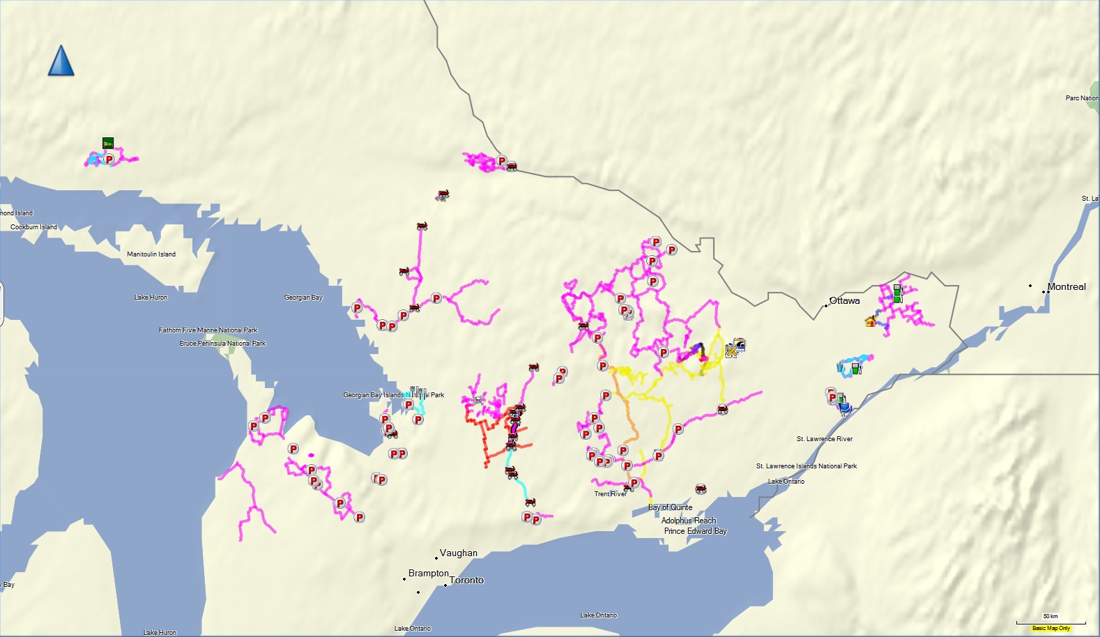
Main Website: http://www.atvontario.com/ There are also some other clubs or organizations that maintain trails and promote ATVing in Ontario that do not (at least according to my research) belong to any one of the Big Three, including, for example: The Ontario Trails Council,The Queen Elizabeth II Wildlands Provincial Park, The Bruce County Trail Network, and I will cover each of these in more detail in Section 4 also. Section 3 - The Big Map.The following map of Ontario is a small-scale map that shows most of the ATV trails in Ontario covered in this article. Not all legal ATV trails in Ontario are shown as some clubs / organizations keep their trail locations secret and/or do not publish any information online, but the majority are represented here and they represent over 5600 km of trails. Click the map for a larger view. |
IMPORTANT NOTE ON GPS FILES (GPX FORMAT) ON THIS SITE: I like to plan ATV trips, both local and long-distance, using Garmin BaseCamp mapping software. It's a pretty neat program and available as a free download for Mac and PC. While doing the research for this article, I compiled as many GPS tracks as possible in BaseCamp. I did this using various methods, including importing GPS tracks from my hand-held GPS of trails I have ridden, downloading GPS tracks from club and other organization websites, and even downloading maps, geo-correlating them, and then overlaying them on other topo maps or Google Earth satellite imagery and hand-tracing the tracks and trails into BaseCamp. Depending on the size, resolution, and accuracy of the original maps I started with, the resulting GPS tracks can vary from accurate to wildly approximate at best. In other words, I cannot and do not claim any degree of accuracy for any of the GPS files available on this site. It is entirely likely that the data contain significant errors. The files are available to provide only a general sense of situational awareness and SHOULD NOT BE RELIED UPON FOR NAVIGATION. Nor should they be taken as proof or evidence of the location or existence of legal trails. The GPS files on this site are provided as a means to assist in trip-planning and locating the general area of trails only - riders MUST always check with the local club or other authority prior to riding, follow all official maps and signs, respect private property, and refrain from trespass. Riders muct always abide by the saying - "If you don't know - don't go!" WHY NOT KEEP TRAIL LOCATIONS AND GPS TRACKS SECRET? I have seen it mentioned that some clubs or organizations prefer to keep the location of their trails and/or GPS tracks secret. The usual explanation for this is to reduce unwanted trespassing. In my opinion, this is a flawed approach and likely to do more harm than good for the ATVing community. The reasons I believe this are as follows:
If you want to download all the trails I have mapped, you can click on this link to download a GPX format file that can then be opened in your favourite mapping software such as Garmin's BaseCamp or even Google Earth, both of which are free downloads. |
OFATV
The Ontario Federation of ATV Clubs (OFATV) is a volunteer driven, not-for-profit organization, dedicated to trail maintenance and development through local volunteer clubs.
Main Website: http://www.ofatv.org
The federation's by-laws are available here. (Alternate PDF file)
Where to Ride
OFATV members/trail pass holders can ride on any existing OFATV trail in Ontario as well as join in on rides and events planned by any OFATV Club.
OFATV members/trail pass holders can also ride on any existing EOTA trails
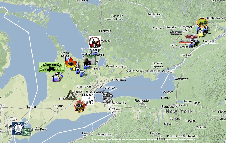
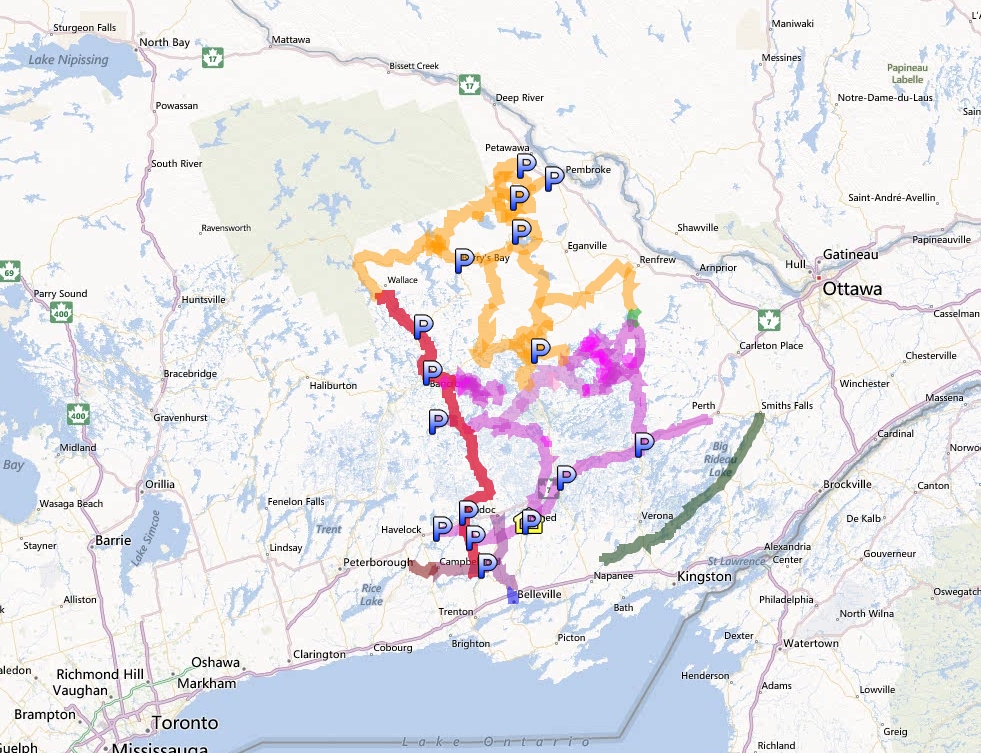
OFATV member clubs and their trails stretch from Windsor to East of Ottawa. The following picture illustrates the OFATV clubs and their locations. Click on the picture to go to the online OFATV interactive trail map where you can pan and zoom in to see the location of actual trails (but not all trails are included on the online map).
Trail Passes / Membership:
"Membership" in the OFATV is automatically granted with the purchase of an annual trail pass. When you purchase your membership/trail pass you also get membership in the local ATV club of your choice. As of this writing the price of OFATV annual membership / trail pass is as follows:
Individual Memberships:
One Year: $150 ($132.74 + tax)Family Memberships:
Member #1: $150 ($132.74 + tax)
Member #2: $150 ($132.74 + tax)
Member #3: $0 (included free)
Member #4: $0 (included free)
The family membership is intended for ATVing families with multiple ATVs registered at the same address. To take advantage of this great savings ALL memberships must be purchased at the same time. Family members may be asked at any time to provide proof of address for all ATVs registered.
According to the OFATV website:
Your new or renewed OFATV Membership is much more than just a trail pass. Joining an OFATV club gives you the opportunity to shape the future of the sport and participate in the development of a province wide trail system. To learn more about the benefits of becoming a member, please visit the Membership Benefits portion of our website www.ofatv.org/membership/benefits
Up to 75% of your membership dollars are used to build and maintain ATV trails in the area in which you chose to sponsor when you purchased your membership. This is why it is extremely important to "buy where you ride? The remaining 25% pays for government taxes, (HST) liability insurance, government lobbying, and helps to cover the operating expenses of the OFATV.
Day Passes
For riders who wish to attend an OFATV event, or try an OFATV trail for a day without buying a full one year membership an OFATV DAY PASS is available from local clubs or retail locations. These day passes are normally in the form of a wrist band that has a permit number and a date, and are only valid for one day. The cost is $20 including tax. If you wish to ride a future date, be sure the date of your ride is properly marked on the band. Each club handles their day passes differently, some require you to contact a club official, or attend a meeting, while others have numerous local businesses offering the passes during business hours. You can visit the web site of the club whose trails you wish to ride for information on locations where day passes can be purchased. For example the ATV Club of Eastern Ontario membership page lists local business establishments where day passes can be purchased.
For a complete list of OFATV clubs see below, or the OFATV club page, or if you are unsure where the clubs are try the OFATV online interactive map which also contains links to the club web sites.
OFATV Rules / Restrictions / Policies
A complete listing of OFATV policies can be found at the OFATV policy page. Some are for the benefit of member clubs and some cover somewhat peripheral topics such as a policy on the display of images (i.e. don't take or publish pictures of people on ATVs destroying the environment). Keeping the focus on trail riding, the following are relevant policies taken from the OFATC website. Obviously by buying a trail pass / membership you agree to abide by them.
OFATV Trail Etiquette & Environmental Guidelines
The Ontario Federation of All Terrain Vehicle Clubs (OFATV) is an organization of clubs that believes riding on designated trails protects the environment. The OFATV promotes safe and responsible riding on trails. It believes that education and awareness programs will further protect the natural environment. At the same time, the utilization of a trail network provides for a unique opportunity to experience nature. ATV' s provide and allow for an increased mobility for a variety of users. The environmental guidelines address the biotic (living organisms) and abiotic
(non-living) components of all ecosystems, and are directed to all trail users, including ATV riders. The OFATV believes the future of utilizing a trail in the outdoors is directly related to how clubs and its members use it today.
- Remove your helmet when talking to other trail users
- Always yield the right-of-way to other trail users who are approaching or passing
- Ride on designated trails. Do not utilize CLOSED trails. 'If you don't know, don't go!'
- Avoid sudden stops and starts and quick directional changes with acceleration
- Avoid sensitive and restricted areas at all times, especially wetlands, lakeshores, steep stream banks and hills
- Cross at designated crossings and utilize bridges when available. Cross watercourses at 90-degree angles and drive carefully and slowly
- Do not venture out on new, non-ATV designated trails without consulting appropriate stakeholders
- Comply with all applicable legislation and/or municipal bylaws
- Keeps in mind the following OTC statement: 'Shared use trail - expect/respect other users.'
- Signal when approaching from behind. In particular, be certain to communicate with the riders of horses and those walking pets
- Avoid running over young trees and shrubs, particularly in the spring and the growing season of the summer
- Do not trespass on private property and do not utilize single-purpose trails designated for other (non-ATV) activities
- Promote parking and dismounting from your ATV to walk to sensitive, scenic, historic and cultural areas
- Enjoy wildlife viewing opportunities, avoid stressing any species particularly during the rearing stages
- Respect and be courteous to other users who are also using shared use trails
- Avoid riding after heavy rains
- Adjust riding behavior according to season and location
- The planning and staging of rodeos and safety courses should be within areas such as pits, gravel parking lots and controlled areas
- Take a rider safety course and ride within your abilities
- Do not cut switchbacks or take shortcuts
- Keep your speed and engine rpm low and steady when approaching other riders, homes, etc.
- What you pack in, pack out - do not litter
- The ATV designated trail season begins and ends with the advent of winter and the appearance of snowmobile groomers
This last one is a little misleading, as their are some trails that are designated for winter ATV riding. In fact, the OFATV has a separate winter riding policy that acknowledged this. It reads as follows:
OFATV Winter Riding Policy
No OFATV club will utilize any trails that are groomed in the winter month unless they are expressly designated for the purposes and use of the ATV club. This includes, but is not limited to, those trails maintained by snowmobile or ski clubs.
OFATV Additional Rules
Of note, when you access the OFATV online interactive map , you are first presented with a disclaimer containing a set of assumptions with which you must agree. It stands to reason then that these additional "assumptions" or guidelines also form a part of the rules with which OFATV members are expected to comply. From the wording it is also apparent that this disclaimer has some roots in legal liability concerns. Some could probably be described as stating the (painfully) obvious, some are common sense, some are redundant if one knows and abides by the laws presented in Section 1, and some are reasonably interesting, at least to those that are new to the sport. The following are these additional "rules":Assumptions for OFATV/EOTA Trail Use
As an off-road experience, ATVing is an inherently risky activity. The OFATV/EOTA assumes every rider using an OFATV/EOTA Prescribed Trail understands and accepts that:
- All ATVs will be operated under a lawful trail use permit;
- All operators and passengers willingly use the trails at their own risk;
- Operators and passengers know and will obey the law, including, The Occupiers’ Liability Act, and the Trespass to Property Act;
- It is recognized and accepted that ATVing is essentially an off-road activity taking place in the natural environment;
- The OFATV/EOTA is a volunteer-based organization with finite resources and manpower;
- It is not practical, possible or desirable to maintain all trails uniformly or to remove all potential hazards;
- The OFATV/EOTA is providing the privilege of trail access without any guarantee of service or quality;
- Operators and passengers will not consume alcohol prior to or while using the trails;
- Operators and passengers will be prudent and responsible and shall ensure that ATVs are operated with appropriate care and control at all times;
- Operators and passengers know how to ATV competently and understand that the operation of ATV requires full cognitive abilities;
- Weather conditions affect trails and ATV operation and they may change without warning;
- The maximum speed on trails is 50 km/h unless reduced by law or conditions;
- There may be permitted users on the trail other than ATVers;
- Operators will stay to the right of the trail notwithstanding that there are no centre lines;
- Operators know that there may be grooming or other maintenance activities under way at any time of the day or night which may take up the whole or any part of the trail and have the right of way;
- Operators and passengers know that ATV trails are not engineered highways;
- Operators and passengers are aware that emergency and cell phone service may not be available;
- Operators and passengers are aware that there are generally no legal requirements for signage on trails and, when provided, it is only for assistance and convenience;
- Operators and passengers know that ATVing on OFATV/EOTA trails is regarded as a family-oriented activity;
- Operators and passengers know the unique and particular dangers of water crossing;
- The grooming and maintenance of trails, when provided, is meant solely to enhance the comfort and enjoyment of the safe and prudent operators and passengers;
- Operators and passengers will dress appropriately for all conditions and will have appropriate safety and emergency equipment at all times.
*** Prescribed Trail Definition – A trail that is maintained by a local club within the OFATV/EOTA organization.
Clubs & Trails:
The clubs of the OFATV are presented below in alphabetical order.
The club / trails data presented below is organized as follows:
- The name of the club and the club's logo are clickable links to the club's home page (if the club has a website).
- The Trail Maps section includes as much data as possible on the trails including (if available):
- links to the club's "Trails" web page.
- links to pictures, PDF files, and interactive online maps of the trails, including locally-stored alternate copies if applicable.
- The GPS section includes links to downloadable GPS track files in GPX, KML, and KMZ formats, if available.
- The Bylaws section includes links to any municipal bylaws regulating ATV use on-road in the area.
- The Rules & Regulations section includes any particular rules or regulations of the club if substantially different from or additional to the Provincial and OFATV rules/regulations/code already presented.
NOTE: It is ALWAYS advisable to check with the appropriate club before heading out riding - either by checking their web page or by calling - to ascertain the condition and state of the trails. Often trails may be closed due to weather conditions, seasonal restrictions (e.g. hunting season, spring-thaw, etc.), trail maintenance, or other reasons. This is particularly important in the case of winter riding as many trails are shared with the Ontario Federation of Snowmobile Clubs and these trails are closed to ATV traffic during the snowmobile season (generally from the first snow / appearance of snowmobile trail groomers until the spring thaw). That said, there are also quite a few club trails dedicated to winter ATV riding.
 |
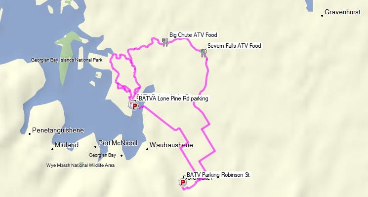
ATV CLUB OF EASTERN ONTARIO INC. |
Approx. 329 km of trails.
Trail Maps:
GPS:
No accuracy or fitness for any use claimed. Not to be used for navigation. Expect errors. May contain significant errors. Not endorsed by any authority or entity. Not to be used as a means of identifying legal trails. Always check with the local club or authority. Follow all official maps and signs, respect private property, and refrain from trespass. Abide by the saying - "If you don't know - don't go!"
By-Laws:
The use of motorized vehicles within the Larose Forest territory is under the jurisdiction of By-Law No. 2010-50 adopted by the United Counties of Prescott and Russell Council.
 |
BAXTER ATV TRAIL RIDERS |
Approx. 90 km of trails.
Trail Maps:
GPS:
No accuracy or fitness for any use claimed. Not to be used for navigation. Expect errors. May contain significant errors. Not endorsed by any authority or entity. Not to be used as a means of identifying legal trails. Always check with the local club or authority. Follow all official maps and signs, respect private property, and refrain from trespass. Abide by the saying - "If you don't know - don't go!"
 |
CENTRAL ONTARIO ATV CLUB |
Approx. 52 km of trails.
Trail Maps:
GPS:
No accuracy or fitness for any use claimed. Not to be used for navigation. Expect errors. May contain significant errors. Not endorsed by any authority or entity. Not to be used as a means of identifying legal trails. Always check with the local club or authority. Follow all official maps and signs, respect private property, and refrain from trespass. Abide by the saying - "If you don't know - don't go!"
 |
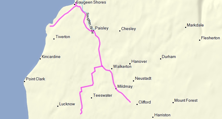
DUFFERIN GREY ATV CLUB |
Approx. 267 km of trails.
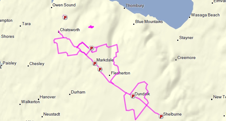
Trail Maps:
Downloadable PDFs
Alternate Downloadable PDFs
GPS:
No accuracy or fitness for any use claimed. Not to be used for navigation. Expect errors. May contain significant errors. Not endorsed by any authority or entity. Not to be used as a means of identifying legal trails. Always check with the local club or authority. Follow all official maps and signs, respect private property, and refrain from trespass. Abide by the saying - "If you don't know - don't go!"
 |
ESSEX COUNTY ATV CLUB |
No Data Available
 |
GREAT LAKES ATV CLUB |
No Data Available
 |
HALDIMAND AREA ATV CLUB |
Trail Maps:
 |
JOHNSTOWN ATV CLUB |
Approx. 40 km of trails.
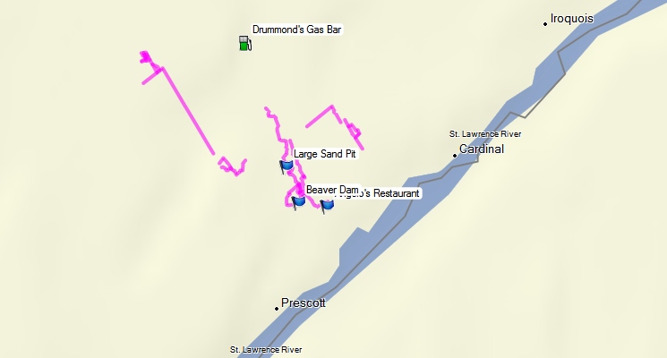
Trail Maps:
Downloadable PDF
Alternate Downloadable PDF
GPS:
No accuracy or fitness for any use claimed. Not to be used for navigation. Expect errors. May contain significant errors. Not endorsed by any authority or entity. Not to be used as a means of identifying legal trails. Always check with the local club or authority. Follow all official maps and signs, respect private property, and refrain from trespass. Abide by the saying - "If you don't know - don't go!"
 |
NATION VALLEY ATV CLUB |
Approx. 100 km of trails.
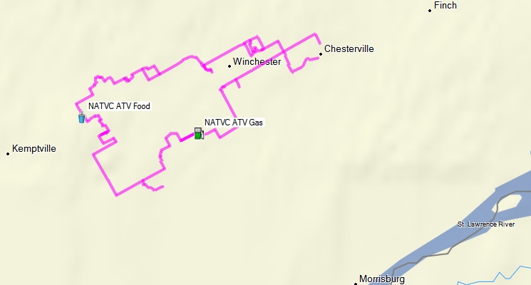
Trail Maps:
GPS:
No accuracy or fitness for any use claimed. Not to be used for navigation. Expect errors. May contain significant errors. Not endorsed by any authority or entity. Not to be used as a means of identifying legal trails. Always check with the local club or authority. Follow all official maps and signs, respect private property, and refrain from trespass. Abide by the saying - "If you don't know - don't go!"
 |
NORFOLK COUNTY ATV CLUB |
No Data Available
 |
OTTAWA VALLEY ATV CLUB |
Note: The Ottawa Valley ATV Club do not publish any trail lists, maps, or coordinates on their website. They do however have this brief description:
Our riding area is nestled in the beautiful Madawaska Highlands of Eastern Ontario. The trails cover a large area which is generally bordered by Calabogie to the north east, Sharbot Lake to the south, Bancroft to the west and the Madawaska River to the north.
So taking that information and data from a variety of other sources, including trails listed on the online EOTA interactive trail map for which there is no clear or obvious affiliated club, I cam up with the following rough guess:
Approx. 690 km of trails.
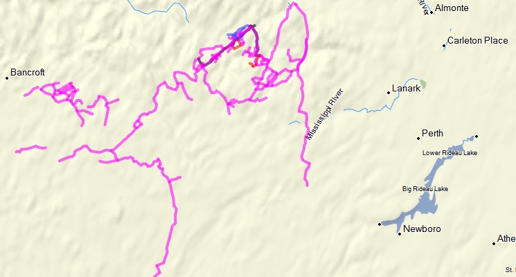
Trail Maps:
GPS:
No accuracy or fitness for any use claimed. Not to be used for navigation. Expect errors. May contain significant errors. Not endorsed by any authority or entity. Not to be used as a means of identifying legal trails. Always check with the local club or authority. Follow all official maps and signs, respect private property, and refrain from trespass. Abide by the saying - "If you don't know - don't go!"
Bylaws:
- North Frontenac Township ATV Bylaw
- Greater Madawaska (Calabogie) ATV Bylaw
- Municipalities that have or have not passed ATV Road Use Bylaws.
Rules & Regulations:
- An OFATV / EOTA trail permit also allows ATV access to the North Frontenac Crown Roads. This is required from April 1st, 2012 through to November 15th, 2012.
- The trail permit also allows for parking of your truck and trailer on North Frontenac Crown Roads. Please put a photocopy of your trail permit wallet card on the dash of your vehicle, you must carry the original with you.
- The trail permit does NOT allow for camping at North Frontenac campsites. A separate North Frontenac camping permit is required for this and is available through the North Frontenac Parklands website
- All club members must adhere to Ontario Provincial Law 316/03 in the operation of their ATV.
- All club members must ride in a socially and environmentally responsible manner. Stay on the trail ! Respect private property. Tread lightly: leave our beautiful wilderness as you found it for all to enjoy.
- All club members must operate their machine in the safest possible manner at all times.
- All club-sponsored runs are dry runs. There is NO TOLERANCE for alcohol or drugs while participating in the run.
- Each person will ride SINGLE FILE with no passing allowed.
- All members MUST HAVE registration (ownership) and valid insurance for their machine, and a valid driver's license.
- No club ride shall take place or continue without first assigning lead and tail riders who are in contact by radio.
- Headlights must be turned on while participating in a group ride.
- Each rider is responsible for staying in visual contact with the rider behind them while participating in a group ride.
- Eastern Ontario Trail Alliance - Trail Rules & Regulations (Link to website)
With winter comes snow and the snowmobiling season. Once Trail grooming starts please stay off the trails.
 |
PRINCE EDWARD COUNTY ATV CLUB |
No Data Available
 |
QUAD NIAGARA ATV CLUB |
No Data Available
The Eastern Ontario Trails Alliance (EOTA)
The Eastern Ontario Trails Alliance (EOTA) is an alliance or umbrella organization created as a vehicle for bringing together people and groups who had an interest in developing a regional trails network. Representatives include municipalities, various trail groups, Chambers of Commerce, Conservation Authorities, and individuals.
The EOTA trail network encompasses trails for ATVing as well as hiking, cycling, horseback riding, canoeing, and snowmobiling.
The major difference between the EOTA and the OFATV is that the EOTA is a trail alliance encompassing activities other than ATVing.
Main Website: http://www.thetrail.ca/
The federation's by-laws are available here. (Alternate PDF file)
Where to Ride
EOTA members/trail pass holders can ride on any existing EOTA trail in Ontario as well as any existing OFATV trails.
Most of the EOTA ATV trails are located in central Eastern Ontario between Algonquin Provincial Park and Lake Ontario. They are situated between Belleville in the South and Petawawa in the North and between Perth in the East and Hastings in the West.
The following picture illustrates most of the EOTA trails and their locations. Click on the picture to go to the online EOTA interactive trail map where you can pan and zoom in to see the location of actual trails (note not all trails are included on the online map).
Trail Passes / Membership:
For ATVers, The EOTA trail pass is, in-fact, exactly the same thing as the OFATV trail pass. The pass itself says on it "Provincial Trail Permit Eastern Ontario Trails Alliance and Ontario Federation of All Terrain Vehicles"
"Membership" in the EOTA is automatically granted with the purchase of an annual trail pass. When you purchase your membership/trail pass you also get the opportunity to select from a list of EOTA ATV clubs to support. As of this writing the price of EOTA annual membership / trail pass is as follows:
Individual Memberships:
One Year: $150.00
Weekly: $75.00
Daily $20.00
Note that the EOTA does not sell a family package like the OFATV does, so if you have more than two ATV riders in the family, purchasing a family plan from the OFATV is probably the better choice.
Membership / Trail Passes can be purchased from EOTA either online or at one of the participating local vendors.
EOTA Rules / Restrictions / Policies
Obviously all the Federal and Provincial rules and regulations already described apply equally wherever one rides an ATV in Ontario. Also, since the EOTA and OFATV trail passes are one and the same, it stands to reason that the previously presented OFATV rules, regulations, and codes of conduct also apply when riding on EOTA trails. That said, this is no explicitly expressed anywhere on the EOTA website. The EOTA website has its own short section of rules which, as you can see, are written slightly differently that OFATV rules as they apply to more than just ATV riders. The EOTA rules, taken from their website, are as follows:
Trails are a wonderful way to spend an enjoyable day, relaxing and taking in the sights. You will see some spectacular scenery and natural areas as you travel the trails. We ask that you observe these few rules of the trail etiquette so that everyone's outing will be fun and you will help preserve trails for future generations.
- Please stay on the main trails! Some areas have rare sensitive plants and small animals that can be easily damaged or destroyed. Don't make new trails or use unmarked (unsigned) trails.
- Some areas may require user fees. Please prepare to pay a fee.
- Please respect neighbouring landowners by staying off private trails and property. Avoid excessive noise.
- Please leave the trail as you found it; whatever you pack in, pack out.
- Please leave the wildflowers and wildlife for others to enjoy.
- Keep dogs on a leash at all times while on the trail.
- ALL USERS to slow to a walking speed when meeting up with other USERS and be prepared to stop.
- Respect and be courteous to other users who are also using shared use trails. Always yield right of way to other trail users who are approaching or passing. Be certain to communicate in advance with riders of Horses, Dog Teams and those walking pets.
- Use bridges for water crossings.
- Please slow down when your vision of the trail is restricted.
- Avoid sudden stops and starts and quick directional changes with acceleration.
Clubs & Trails:
The EOTA website page for trails and maps contains a link to the online EOTA interactive trail map where you can pan and zoom in to see the location of actual trails and also save the trails in KML or GPX format.ATV Clubs affiliated with the EOTA are presented below in alphabetical order. I compiled this list from the EOTA online trail pass application which gives a selection of ATV clubs that can be chosen to be supported.
The club / trails data presented below is organized as follows:
- The name of the club and the club's logo are clickable links to the club's home page (if the club has a website).
- The Trail Maps section includes as much data as possible on the trails including (if available):
- links to the club's "Trails" web page.
- links to pictures, PDF files, and interactive online maps of the trails, including locally-stored alternate copies if applicable.
- The GPS section includes links to downloadable GPS track files in GPX, KML, and KMZ formats, if available.
- The Bylaws section includes links to any municipal bylaws regulating ATV use on-road in the area.
- The Rules & Regulations section includes any particular rules or regulations of the club if substantially different from or additional to the Provincial, OFATV, and EOTA rules/regulations/code already presented.
NOTE: It is ALWAYS advisable to check with the appropriate club before heading out riding - either by checking their web page or by calling - to ascertain the condition and state of the trails. Often trails may be closed due to weather conditions, seasonal restrictions (e.g. hunting season, spring-thaw, etc.), trail maintenance, or other reasons. This is particularly important in the case of winter riding as many trails are shared with the Ontario Federation of Snowmobile Clubs and these trails are closed to ATV traffic during the snowmobile season (generally from the first snow / appearance of snowmobile trail groomers until the spring thaw). That said, there are also quite a few club trails dedicated to winter ATV riding.
| FRONTENAC ATV CLUB |
By-Laws:
South Frontenac
http://www.township.southfrontenac.on.ca/Bylaws/2005-25.atv..pdf
North Frontenac
http://www.mazinaw.on.ca/northfrontenac/
Central Frontenac
http://www.centralfrontenac.com/
Stone Mills
http://www.stonemills.com/
Addington Highlands
http://www.mazinaw.on.ca/addington/
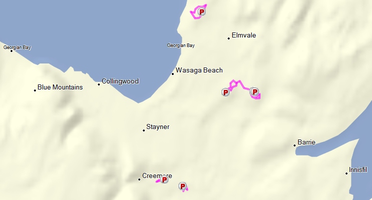
| HAVELOCK & DISTRICT ATV CLUB |
Approx. 210 km of trails.
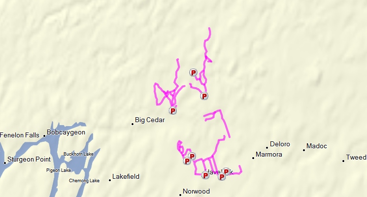
Trail Maps:
GPS:
No accuracy or fitness for any use claimed. Not to be used for navigation. Expect errors. May contain significant errors. Not endorsed by any authority or entity. Not to be used as a means of identifying legal trails. Always check with the local club or authority. Follow all official maps and signs, respect private property, and refrain from trespass. Abide by the saying - "If you don't know - don't go!"
By-Laws:
Havelock Belmont Methuen Township Bylaw 2010 (PDF)
| HURON SHORES ATV CLUB |
Approx. 123 km of trails.
Trail Maps:
GPS:
No accuracy or fitness for any use claimed. Not to be used for navigation. Expect errors. May contain significant errors. Not endorsed by any authority or entity. Not to be used as a means of identifying legal trails. Always check with the local club or authority. Follow all official maps and signs, respect private property, and refrain from trespass. Abide by the saying - "If you don't know - don't go!"
 |
Northumberland District ATV Club |
Trail Maps:
By-Laws
Rules & Regulations
- I will be a good sports person. I recognize that many people will judge all ATV owners by my actions. I will use my influence with other ATV owners to promote responsible conduct.
- I will maintain clean trails and use areas. I will work to safeguard clean and pure streams and lakes. I will ensure my ATV use has the lowest possible impact on the environment. I will safeguard living trees, shrubs, and other natural features.
- I will respect other people’s property and rights.
- I will lend a helping hand when I see someone in distress.
- I will make my vehicle and myself available to assist in emergency situations.
- I will recognize the rights of other user groups.
- I will energetically strive to bring other recreation participants to recognize and respect my rights as an ATVer by explaining my needs and, at the same time, listening to their needs.
- I will learn and obey all federal, provincial, and municipal rules regulating the operation of ATV’s in areas where I use my vehicle. I will inform public officials, as required, when using public lands.
- I will not harass wildlife, and will become aware of protected or sensitive areas.
- I will use marked trails, and areas open to ATV’s. I will not travel where prohibited.
- I will not ride under the influence of non prescription drugs or alcohol.
- I will always wear required safety equipment while operating my ATV.
| QUINTE WEST ATV CLUB |
By-Laws
City Of Quinte West 2011 ATV By-law Print
City Of Quinte West 2011 ATV By-law Map
| Renfrew County ATV Club |
Approx. 827 km of trails.
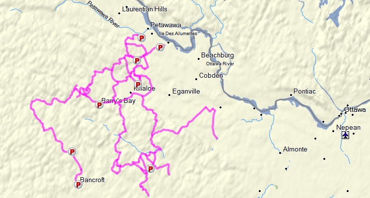
Trail Maps:
GPS:
No accuracy or fitness for any use claimed. Not to be used for navigation. Expect errors. May contain significant errors. Not endorsed by any authority or entity. Not to be used as a means of identifying legal trails. Always check with the local club or authority. Follow all official maps and signs, respect private property, and refrain from trespass. Abide by the saying - "If you don't know - don't go!"
| SOUTH BRUCE PENINSULA ATV CLUB |
Approx. 164 km of trails.
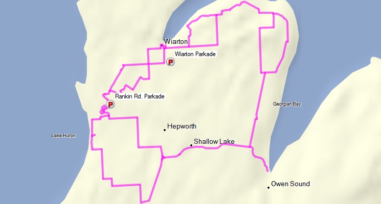
Trail Maps:
GPS:
No accuracy or fitness for any use claimed. Not to be used for navigation. Expect errors. May contain significant errors. Not endorsed by any authority or entity. Not to be used as a means of identifying legal trails. Always check with the local club or authority. Follow all official maps and signs, respect private property, and refrain from trespass. Abide by the saying - "If you don't know - don't go!"
Rules / Code:
ATV Ontario (ATVO)
ATVOntario is a marketing alliance established as a public/private initiative between the Ontario Tourism Marketing Partnership Corporation (OTMPC) and the 5 founding communities Elliot Lake, Mattawa, Eastern Ontario (Tweed), Cochrane and Georgian Bay (Parry Sound).
ATVOntario's goal is to advance the Province of Ontario as the preeminent ATV tourism destination in North America.
Main Website: http://www.atvontario.com/Where to Ride
ATVO PowerPass holders can ride on ATVO trails in Ontario.
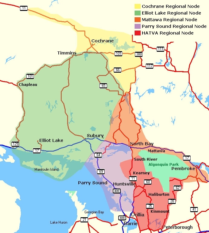
According to their website, ATVO has 6000 km of trails available. They are situated between Peterborough in the South and Cochrane in the North and between Pembroke in the East and Chapleau in the West. The entire ATVO riding area is divided into five regions called "nodes". The following diagram illustrates the five ATVO "Nodes".
Trail Passes / Membership:
Unlike OFATV and ETO, the ATVO "PowerPass" isn't a membership in the organization or in an associated club. It is just a trail pass. According to the ATVO website:
PowerPass Ontario™ is unique in that it is complementary to the community trail pass systems already in force on their routes. Community passes, including daily, weekly and annual passes coexist with PowerPass Ontario™ in ATVOntario...PowerPass Ontario™ revenues are distributed equally amongst ATVOntario's 5 community nodes. This means that each community's ATV infrastructure and trail systems will benefit equally and will therefore be enabled to provided increased ATVing enjoyment for you in the future.
Essentially, the PowerPass is a "Reciprocal Pass" meaning it is one pass that is good in any of the trail systems / communities in any of the five nodes. So a PowerPass will allow you to ride the ATVO trails in any of the five nodes, but if you wanted to belong to a club in the region you would also have to purchase membership in that club.
The PowerPass is available only on an individual basis, at a cost of $135.60 ($120 + HST). There is no family plan, weekly, or daily pass.
In addition:
- The PowerPass Ontario™ permit is valid for one full year after purchase no matter when you buy it.
- PowerPass Ontario™ is only available online.
- Once your PowerPass Ontario™ is purchased online you can immediately print a receipt so that you can use your pass within minutes of registering. ATVOntario will mail you a plastic credit card sized pass that will fit right in your wallet.
- Your PowerPass Ontario™ card is personalized. The front of the card will have your name, number and expiry date. The back of your card will have your ATV make and license plate number and a magnetic strip that can be used in future for special retail opportunities.
- PowerPass Ontario™ allows dual use.
- The card you are issued will permit you to ride ATVs other than your own on our trails. Simply provide a valid photo identification that matches the name on the face of the card and you are all set.
- The card also allows others to drive your ATV provided the make and license number on the rear of the card matches your ATV and license plate.
ATVO Rules / Restrictions / Policies
- It is understood that all POWERPASS holders are sixteen years of age or older and must have their ATV plated and insured and wear an approved helmet at all times when riding the trails.
- An 'in-force' PowerPass Ontario subscription is valid only for the same uses and timelines that are permitted by current community trail pass systems.
- Obey all signs and abide by the Highway Traffic Act, Offroad Vehicle Act, Trespass Property Act and County and Municipal bylaws.
- Stop when requested to by trail wardens or bylaw officers or police officers.
Nodes, Clubs & Trails:
Some of the ATVO Nodes have associated clubs and some do not (at least not as far as I can tell). Some of the nodes have some trail information / maps available online, and others do not. One of the nodes appears to have no information other than the contact name of a business that appears to conduct paid ATV tours for customers. So, with that said, the information below is a little less consistent and a little more haphazard than that for the OFATV and the EOTA. Nevertheless, I have attempted to include all the information possible.
The nodes of ATVO are presented below. Where it is available, node / club / trail data is presented below in a format similar to that used above for the OFATV and EOTA.
Cochrane Regional Node
Note: The Chocrane node of ATVO website offers little more than a link to a company called Bear Tracks ATV Tours, with the following brief blurb:
Come and ride your ATV through the Northern Wilderness. Based out of Cochrane Ontario Bear Tracks ATV Tours provided guided tours using your ATV as a primary mode of transportation. Ride the streets of Cochrane, visit our Polar Bears at the Polar Bear Habitat & Heritage Village, or take a tour you won't regret.
If you are looking for a leisurely family ride or looking for an extreme mud filled trip we can take you where you want to go. The scenery is breathtaking... You may even see a bear or moose while on your ride.
There is also a link to a web address that is now defunct. It is not at all clear what the purpose of the PowerPass in the Chocrane node or if there are trails it allows you to ride. There are no trail maps, coordinates, or even maps offered for sale or other data available on the website.
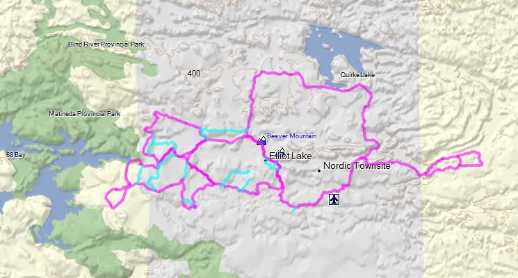
Elliot Lake Regional Node
The Elliot Lake node of ATVO website contains very little data and appears to concentrate on selling packages linked to purchasing accommodation at several "partners". However, the website does state:
Over 300 km of trail within 50 km of the City...Our trails have been designed for riders of all ages, whether seasoned or novice. They are perfect for day trips, overnight stays or extended three- to five-day excursions. As the trails are looped, riders are never more than a 20-minute ride from the necessary services and amenities of the city...To find out how you can obtain a more detailed map which includes GPS coordinates, contact the Elliot Lake Welcome Centre at 1.800.661.6192.
But there are no trail maps, coordinates, or other data available on the website.
Fortunately, better data is available from the city of Elliot Lake Tourism ATV website, including an Elliot Lake Tourism ATV online Trail Map.
There is also some good data, including a list of waypoint coordinates available on the Elliot Lake ATV Club website.
The following picture illustrates the Elliot Lake trails, taken from the Elliot Lake Tourism ATV website.
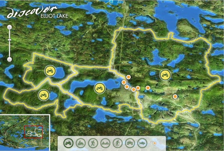
There are four main ATV trails in Elliot Lake, described as follows:
Boardwalk Run
Distance: 41 km
Rating: Easy/Moderate
Short section of Moderate/Advanced is avoidable
Description
This loop signifies the first trails developed by the Elliot Lake ATV Club and highlights interconnecting trails through a variety of terrain with scenic views. This loop is the main link to the Boreal Forest Run and the Portage Run and literally wraps tightly around the city - although the city is rarely visible. The trails leaving Elliot Lake are as scenic as even the most remote trails. Great views across Horne Lake and Elliot Lake and some great water crossings really make the trail feel isolated.
Once outside the city, the trail follows the attractive powerline trail with some of the most expansive vistas in the area. At the river joining Elliot Lake and Quimby Lake, two bridges provide some of the most photographed landmarks on the trails and are impressive when the water is high. This same area provides access to the high rocks with an amazing view and to a great picnic, camping or rest spot on Elliot Lake. The fishing from this area is incredible as well.
The route provides various escapes prior to entering the slightly more difficult sections. One trail leads directly to one of Elliot Lake's public beaches in the heart of the city.
The remainder of this trail is slightly narrower and moderately difficult due to rugged terrain. While it isn't difficult, experienced riding is encouraged. The trail accesses an interesting boardwalk, which was built to restore water flow and preserve environmental features close to the city while easily accommodating ATV traffic.
Boreal Forest Run
Distance: 47 km
Rating: Easy to Moderate
Description
This route starts along the awesome power line - a long time favourite snowmobile trail because of the expansive views and open trail. It's even better in ATV season when the leaves are on the trees. The power line trail is mostly former road bed with various bridge crossings. The vistas from some of the hilltops are truly spectacular and provide for some of the greatest fall colour viewing.
From the power line, the trail leads quickly into an old growth forest evident by enormous pine trees and stumps, exposed roots and slopes covered in wildflowers - all rare along an ATV trail in Ontario. Mixed with strands of birch trees, this area is vivid with yellow in the fall.
This trail can be connected to the Portage Run or the Boardwalk Run to connect back to the city or to extend the ride.
May Lake Loop
Distance: 60 km
Rating: Moderate
Description
This trail is one of the first and only known trails funded and built in partnership between an ATV club and a snowmobile club in Ontario. It provides access to the rugged wilderness east of the city. The trail can also be extended to Whiskey Lake far a real distant adventure.
The south-east edge of this route provides a scenic backdrop that is well worth the ride. The rock cliffs seem to go forever and are so high that they create a backdrop along much of the trail. Heading north, the trail narrows and begins to travel across bridges between various lakes providing some great rest areas and fantastic views. The route travels Stanrock Road for an extent, providing a glimpse of Elliot Lake's modern lakefront development project.
Portage Run
Distance: 49 km
Rating: Advanced
Description
This looped trail is renowned for a challenging ATV ride through rough, muddy and rocky sections of trail and is recommended for advanced riders with four wheel drive ATVs. Sections of trail are open depending on season, water and weather conditions.
This route is an extension of the Boreal Forest Run or the Boardwalk Run. The destination is a fantastic view of Lake Matinenda. The ride passes through tight, muddy trails and along some great sections above Quimby Lake.
| Elliot Lake ATV Club |
Approx. 200 km of trails.
Trail Maps:
GPS:
No accuracy or fitness for any use claimed. Not to be used for navigation. Expect errors. May contain significant errors. Not endorsed by any authority or entity. Not to be used as a means of identifying legal trails. Always check with the local club or authority. Follow all official maps and signs, respect private property, and refrain from trespass. Abide by the saying - "If you don't know - don't go!"
By-Laws:
By-law No. 09-48
Rules & Regulations
All visitors must have a valid Trail Pass. The ATVO PowerPass is acceptable, or Elliot Lake Trail Passes are available at the Elliot Lake Chamber of Commerce / Welcome Center, 100 Highway 108, Elliot Lake. Ph. 705.848.7737 or 800.661.6192. The following are the rates for the Elliot Lake only pass:
· Weekend Special Trail Pass 2Day $36.00
· 3-Day Visitor Trail Pass $45.00
· 7-Day Visitor Trail Pass $85.00
· Non Resident Seasonal Trail Pass $100.00
· 2011 Ontario Resident Seasonal Pass $75.00
· Special Event / One Day Pass $20.00
· Special Event / 5-day Pass $81.00
Mattawa Regional Node
The Mattawa Node website proclaims:
In Mattawa ride your ATV from your accommodation to the trailhead and then experience 150 kilometers of diverse trails. The trail system is nestled between two small mountain ranges, the Algonquin Highlands and the Laurentian Mountains, and is bordered by the Mattawa and Ottawa Rivers. This site-seeing paradise with constantly changing terrain offers the bold ATV adventurer challenging rock climbs and wet muddy areas.
Of course, easy riding is also an option with trails meandering through majestic pines and cool valleys speckled with clear lakes and rivers. Welcoming accommodations and restaurants are easily accessible and fuel is readily available in town and on the trail. Immerse yourself in this scenic wilderness, all within an easy drive from Toronto and Ottawa.
VMUTS
One of the most prominent trail riding areas in the Mattawa area is known as the Voyageur Multi-Use Trail System (VMUTS).
As the name implies, the VMUTS is a multi-use trail system used by mountain bikers, horseback riders, dirt bikers, and 4wd truck drivers as well as ATVers. The VMUTS has its own website, and its own trail pass system with the following prices:
1 Day - $ 12.00
3 Days - $ 20.00
1 Week - $ 30.00
Annual - $ 50.00
But an ATVO PowerPass will also allow you to ride the trails of the VMUTS.
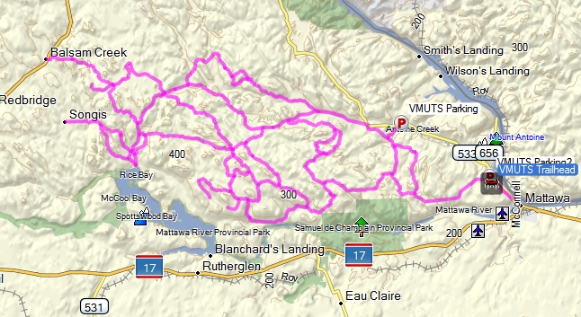
The following picture illustrates the location of the VMUTS, situated to the West of the town of Mattawa Ontario.
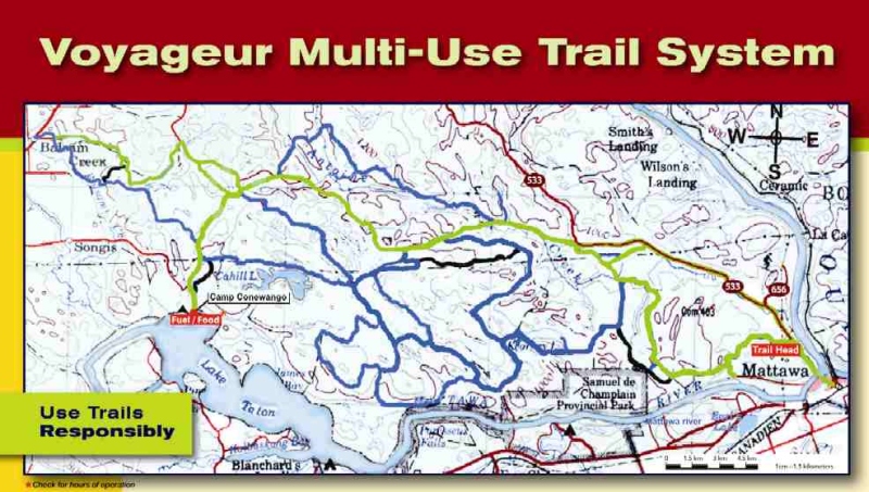
The following data, taken from the VMUTS website describes the area:
The Voyageur Multi-Use Trail System (VMUTS) occupies a superbly scenic area between the ancient Algonquin Highlands and Laurentian Mountains, bordered by the Mattawa and Ottawa Rivers. With a small population of only two thousand residents, the kind and helpful community of Mattawa offers visitors an intimate and welcoming atmosphere. You'll find the trails only a few minutes from town. Take Hwy 533 and follow the signs.
Trail Description
· VMUTS trails are comprised mainly of old, forest-covered logging roads with river/stream crossings (many via bridges and culverts).
· VMUTS has trails suited to the needs of novice, intermediate and advanced riders.
· The trails are arrayed from the Trail Head in clearly marked loops of various lengths and levels of difficulty.
· It would take more than two weeks to experience VMUTS in it's entirety.Local ATV By-Laws
· Local by-laws permit riding ATVs on secondary roadways without passengers (passengers are allowed on VMUTS trails). Riding on highways is not permitted (even on the shoulder). UTV/Side-By-Side/Two-Up are not permitted on any roadways.
· Don't forget your trail pass, map, vehicle ownership and insurance documents!
SAFETY
· Wear helmets as required
· Watch for other trail users
· Operate vehicles with lights onHow do I get to the Voyageur Multi-Use Trail System from Mattawa?
The trails are only a 3-minute ride from the town of Mattawa.
Take Hwy 533, turn left onto Murphy's Road and follow it to the end where the Trail Head is located.
There are signs to direct you as you proceed from Mattawa to the 533.How do I get a trail map?
Trail maps are included with the purchase of a trail pass. Click here for a list of sellers and fees.
Approx. 200 km of trails.
GPS:
No accuracy or fitness for any use claimed. Not to be used for navigation. Expect errors. May contain significant errors. Not endorsed by any authority or entity. Not to be used as a means of identifying legal trails. Always check with the local club or authority. Follow all official maps and signs, respect private property, and refrain from trespass. Abide by the saying - "If you don't know - don't go!"
 |
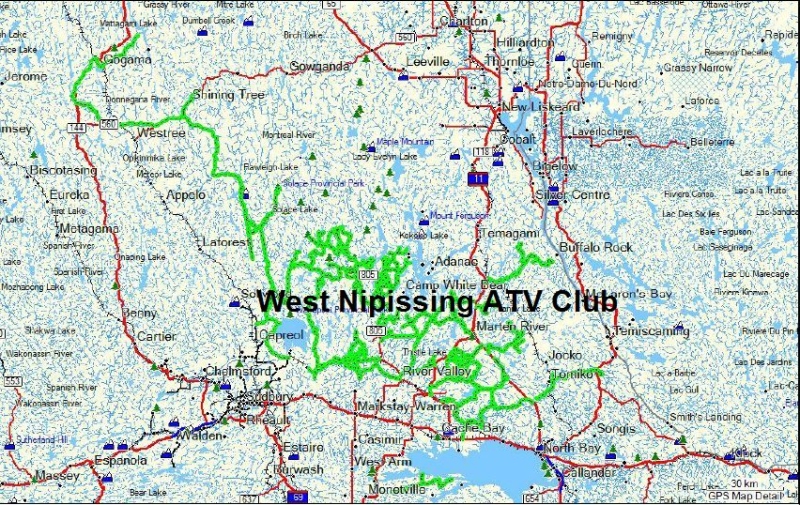
West Nipissing ATV Club |
Trail Maps:
No information available publicly available except the following picture. There is a "Map Area" on the website but it is listed as "members only" and requires login credentials.
By-Laws:
Rules & Regulations
- A member of the W.N. ATV Club VTT N.O. must possess an ATV driving license and/or a valid driver's license
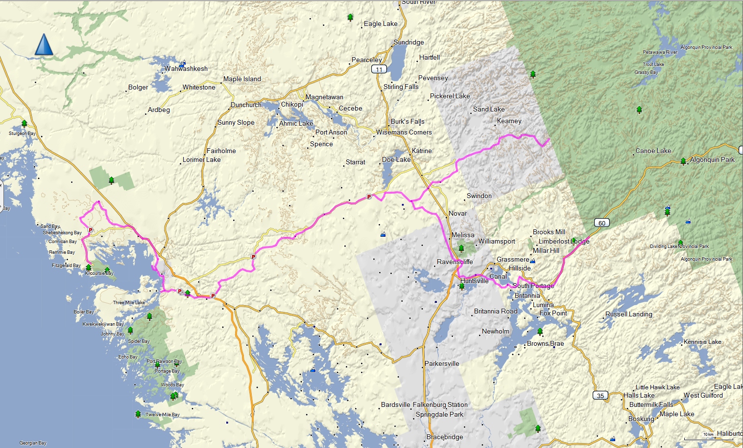
Parry Sound Regional Node
According to the Parry Sound Regional Node website:
The main trail system in the Parry Sound/Georgian Bay area is our Park-to-Park Trail, an exciting 74 km route set within a natural paradise of lakes, rivers, forests, beaches, and the 2.5 billion-year-old granite of the Canadian Shield that come together to form a rich tapestry of Canada's natural, historical and cultural heritage.
Less than two hours north of Toronto, Parry Sound is a four-season destination that offers restaurants, fine hotels, or a night under the stars. Best of all, our trail systems provide riders with boundless freedom and a chance to explore the majestic Canadian Shield.
The Park to Park Trail Association is an incorporated association that has worked to develop, build and maintain trail across the 10 municipalities between Killbear and Algonquin Provincial Parks.
The following picture shows the location of the Park to Park trail. Click for a larger view.
Approx. 230 km of trails.
Trail Maps:
GPS:
No accuracy or fitness for any use claimed. Not to be used for navigation. Expect errors. May contain significant errors. Not endorsed by any authority or entity. Not to be used as a means of identifying legal trails. Always check with the local club or authority. Follow all official maps and signs, respect private property, and refrain from trespass. Abide by the saying - "If you don't know - don't go!"
The Park to Park Trail Association website states:
The Park to Park Trail network includes trail sections of historic rail beds and colonization roads, as well as newly developed trail, and road sections. We are a multi-use trail network, welcoming trail users on foot, bicycle, horse, dog sled, dirtbike, snowmachine, ATV and UTV. Some sections are limited to non-motorized users, so please check out “Get on the Trail” to see what uses are permitted for each section of trail you wish to use.
OUR MANDATE
To coordinate and promote the development, operation and maintenance; through individuals, members, groups, organizations, corporations, municipalities and all levels of government; an integrated, year-round, multi-use recreational trail, connecting Killbear to Algonquin Provincial Park, and providing links to several communities, features, attractions, and services in Parry Sound, Muskoka, Almaguin Highlands and Algonquin, as well as other provincial parks and trail networks including the Trans Canada Trail.
Park to Park Trail Passes
Like the VMUTS in the Mattawa Node of ATVO, the Park to Park Trail Association has their own trail pass system. Also like the VMUTS, the Park to Park Trail is a multi-use system of trails with many different types of users besides ATV riders. Passes are required along the entire trail route maintained by the Park to Park Trail Association and all Trail Pass dollars go to trail development and maintenance.
Park to Park Trail Pass fees for ATV use are as follows:
- Day: $23
- Week: $56
- Year: $120
Important Trail Pass Facts:
- Permits are issued to the person, not the machine/vehicle
- Prices include all applicable taxes
- All pass holders must sign conditions of sale before passes will be issued
- ATV/UTV/Trail Bike use on the trail is seasonal from April 1st to November 30th. Snowmobiles use the trail from December 1st to March 31st.
- ONLY ATV Ontario’s “Power Pass” and Park to Park Trail Association’s “Park to Park Trail Pass” are valid and acceptable trail passes on the Park to Park Trail System.
As of this writing, the ATVO PowerPass is valid for use on the Park to Park trail but the following is posted on the website:
Please note that effective November 15, 2013 the Park to Park Trail system (Georgian Bay/Parry Sound) will no longer honour ATVOntario's PowerPass.
HATVA Regional Node
"HATVA" stands for Haliburton ATV Association. The HATVA is sort of a super-club in that it is an "association" and has at least two "member clubs" (the Algonquin West ATV Club and the North Hastings ATV Association) but is also a club in its own right and has membership, trails it maintains, and organized rides and activities like a club.
The ATVO web page for the HATVA Regional Node is here.
HATVA's own website is here.
According to their website the HATVA has over 1700km of ATV trails covering the Haliburton, Kawartha, Madawaska, Peterborough & Muskoka regions.
Membership / Trail Pass
Like many of the other organizations that fall under the umbrella of ATVO, the HATVA has its own membership / trail pass system and rates, but an ATVO PowerPass is also acceptable for use on HATVA trails.
The individual annual rates for a HATVA pass is $110.00 (tax included).
HATVA also offers day, weekend and weekly temporary passes that can be ordered online from their site or purchased at local retailers in the Haliburton area. The rates are:
- Single Weekly Membership (trail pass) $40 CDN
- 2 Day Weekend Pass $25 CDN
- Daily Membership (trail pass) $15 CDN
HATVA also offer a family membership. According to their site, it is intended:
...for members of a direct family unit living under the same roof E.G. Mom, Dad and Kids. It does NOT include adult children living away from home, extended family, brothers and sisters at different residences, uncles aunts etc. It is intended to offer a break to parents raising children at home on a family income.
The rate is:
- Annual Family Membership $220 CDN
Annual & Annual Family Membership Benefits Include:
- access to HATVA trails
- All Terrain Vehicle magazine subscription
- club decal
- numerous club rides & events
- HATVA club trail insurance
- a voice in the future of ATV use in Ontario
- ATV training programs
- search & rescue training and affiliation
- free full colour map of HATVA trails
In addition to the ATVO PowerPass being valid for use on HATVA trails, the following additional reciprocal trail pass agreements are also in place as of the time of this writing:
- HATVA, ATVO PowerPass & Kawartha ATV Association (KATVA) passes are valid on HATVA trails.
- ATVO Power Pass works on all HATVA trails but it does not work on the KATVA / Ontario Trails Alliance Victoria Rail Trail south of Kinmount.
- KATVA pass works on all HATVA trails (except Haliburton Forest winter trails) but does not work on other ATVO PowerPass Nodes.
Trail Maps:
Club Web Page (note that HATVA publish no maps, directions, or coordinates online, but do offer to sell a paper map).
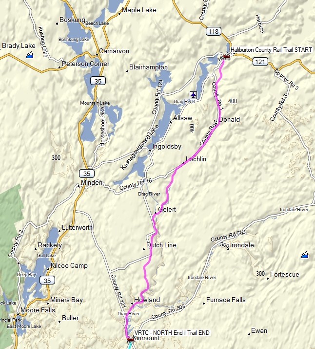
Haliburton County Rail TrailOne of the trails in the HATVA area is the Haliburton County Rail Trail which is one of two trails of the Ontario Trails Council where ATV use is permitted (The other is the Victoria Rail Trail which is looked after by the Kawartha ATV Association, a stand-alone ATV club / association that is not affiliated with OFATV, EOTA, or ATVO - see later in this article for details).
The Rail Trail is a Municipal owned trail along an abandoned rail line that extends 35km from the community of Haliburton south to the community of Kinmount. Here is a diagram of the trail:
The only reason I mention this particular trail specifically here is that, due to the information available on the Ontario Trails Council website, I was able to put together what I believe is a reasonably accurate GPS trace of this trail, which you can download below.
GPS:
No accuracy or fitness for any use claimed. Not to be used for navigation. Expect errors. May contain significant errors. Not endorsed by any authority or entity. Not to be used as a means of identifying legal trails. Always check with the local club or authority. Follow all official maps and signs, respect private property, and refrain from trespass. Abide by the saying - "If you don't know - don't go!"
By-Laws:
Rules & Regulations
- It is understood the all members and trail pass holders are twelve years of age or older and must have their ATV plated and insured and wear an approved helmet at all times when riding the trails. Children between 12 and 16 must be supervised by a guardian. It is recognized that the Off Road Act allows participation of children under 12 while being supervised by an adult parent or guardian however riders under 12 cannot become members according to HATVA bylaws.
- Obey all signs and abide by the Highway Traffic Act, Offroad Vehicle Act, Trespass Property Act and County and Municipal bylaws.
- Stop when requested to by trail wardens or bylaw officers or police officers.
- HATVA Association does not operate on any snowmobile trails after winter trail grooming has become.
HATVA Associated Clubs:
 |
Algonquin West ATV Club |
(No trail descriptions or maps posted online)
| North Hastings ATV Association |
Approx. 260 km of trails.
Trail Maps:
Club Web Page
GPS:
No accuracy or fitness for any use claimed. Not to be used for navigation. Expect errors. May contain significant errors. Not endorsed by any authority or entity. Not to be used as a means of identifying legal trails. Always check with the local club or authority. Follow all official maps and signs, respect private property, and refrain from trespass. Abide by the saying - "If you don't know - don't go!"
By-Laws:
All the municipal roads in Haliburton county are now open, with the exception of the main street in the town of Haliburton
Other Nonaligned (Independent) Ontario ATV Clubs
The following are other ATV clubs in Ontario that are not a part of or allied with OFATV, EOTA, or ATVO. That means, in order to ride any of their trails you would need to purchase a membership or trail pass from that clubs specifically - with two exceptions. First, some clubs may have "reciprocal pass" agreements with other clubs - meaning that if you own a pass for one club, you may be permitted to ride another clubs trails. One of the most well-know examples of this is the reciprocal agreement between the HATVA and the KATVA (details above in the HATVA section and below in the KATVA section). Secondly, it is permissible to ride on trails that are on Crown Land, even if those trails form part of the trail network maintained by a club or association. In other words, a club or association does not have the right to ban or prohibit you from Crown Land. However, there are a few important things to note:
- If any part, even a tiny part, of a trail crosses anything other than crown land (i.e. if it crosses private land or municipally owned land) then you may not ride on that portion without the appropriate trail pass. If you do, you will be in violation of the Trespass Act and can be charged appropriately. Note that not all trails on crown land are accessible without crossing some private or municipal land, so essentially they are impossible to get too without breaking the law.
- It is generally considered poor form by many to ride without a trail pass and therefore not support the clubs and organizations who work hard to open and maintain trails for all ATVers to use. For example, many clubs maintain trails on crown land, and it costs them a lot of money and volunteer manpower to do so. Although this doesn't give them the right to prohibit you from being on that Crown Land - it is understandable why the community would take a dim view of using trails built and maintained by others without contributing your fair share.
- ATVers face constant threats from radical environmentalists and other groups who would like nothing more than to see ALL forms of motorized recreation banned from everywhere. These people are highly motivated, organized, and often well funded. They are a formidable opponent. Also, although it is currently permissible to ride an ATV on Crown Land, this is not codified by law or statute (unlike snowmobile trails) and therefore the right to do so is subject to being revoked at any time. What the ATV community needs to do to oppose the loony greenies and to protect the right to ride on Crown Land (and hopefully to eventually secure legal rights to Crown Land trails like snowmobilers have) is to work together. The best way you can do this, for the good of the trails, the sport, and the future of ATV riding in Ontario is to buy a trail pass and support those who work hard to keep trails open, maintained, and safe.
 |
Ausable River Riders Club |
Trail Maps:
The only information on the club website regarding trails is the following:
There are two riding areas one in Sylvan near Arkona and one in Parkhill. After the purchase of your day pass or membership we will provide you with detailed directions and maps for both riding areas.
Rules & Regulations
- Our trails are available everyday from April 1st through to October 31st. We discourage riding on the trails during excessively wet times (i.e. during and / or after rain).
- If a rider has more than one machine, a single pass can be used and transferred between machines.
- If more than one person rides a machine, a single pass is all that is required for the machine although anyone riding it must sign a waiver.
 |
Kawartha ATV Association |
The Kawartha ATV Association (KATVA) is one of the largest ATV clubs in Ontario and is certainly the largest nonaligned club.
Where to Ride
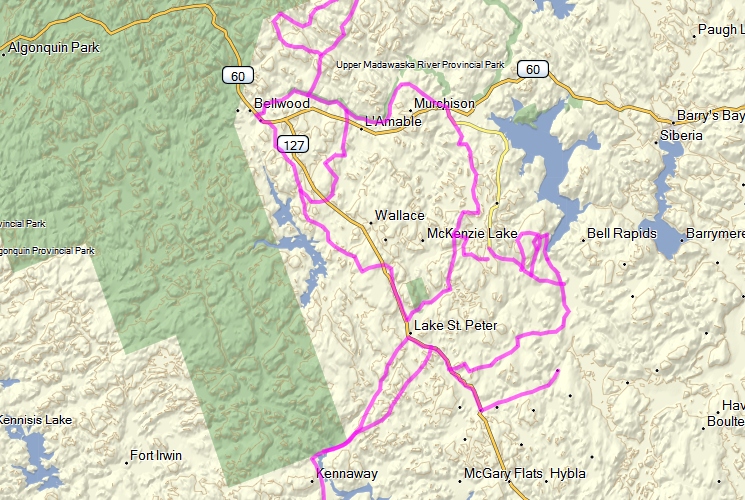
The KATVA trails are located in central Ontario between Lake Simcoe in the West and Peterborough in the East, centred around the City of Kawartha Lakes.
The following diagram illustrates the general area of the KATVA trails, but does not show all of the trails.
More details below on the trails themselves.
Trail Passes / Membership:
KATVA has its own membership / trail pass system and rates.
The individual annual rates for a KATVA pass is $110.00 (tax included).
KATVA also offer a family membership for up to 4 family members residing at the same address. Note that, according to their rules, all members have to be at least 16 years of age AND poses a valid driver's licence.
The rate is:
- Annual Family Membership $220 CDN
KATVA also offers day, weekend and weekly temporary passes that can be purchased at local retailers in the Kawartha Lakes area. The rates are:
- Single Weekly Membership (trail pass) $40 CDN
- 2 Day Weekend Pass $25 CDN
- Daily Membership (trail pass) $15 CDN
KATVA have the following reciprocal trail pass agreements in place as of the time of this writing:
- KATVA passes are valid on HATVA trails (except Haliburton Forest winter trails) but does not work on other ATVO PowerPass Nodes.
- ATVO PowerPass does not work on the KATVA trails or Ontario Trails Alliance Victoria Rail Trail south of Kinmount.
Trail Information
The KATVA trails are broken down into
The Somerville Forest is a Multi-Use Trail system Owned and Administered by the City of Kawartha Lakes.
Approx. 17 km of trails
The Five Points System is an intermediate to expert trail system north of Bobcaygeon.
The Ontario Trails Council. Victoria Rail Trail
The Queen Elizabeth II Wildlands Provincial ParkThe Victoria Recreation Corridor is a rail trail that follows the former CN rail line and stretches from Lindsay, Ontario to Kinmount Ontario. It is 55 km in length and is Owned and Administered by the City of Kawartha Lakes. The trail is used year-round by multiple users. ATVs are restricted to May 1st to Nov. 30th., 7:00am and 9:30pm.
Approx. 75 km of trails.
The Queen Elizabeth II Wildlands Provincial Park is a "non-operating" Provincial Park. The Ontario Parks website has this to say about the park:
Formerly known as Dalton Digby Wildlands, this park is one of the most diverse and least disturbed natural areas found in Central Ontario. Containing more than 50 landform vegetation patterns, this site has limited or no recent history of logging. Its low-rolling topography includes organic soils, flat sandy deposits, and bare bedrock uplands with shallow soil patches.
This area is used extensively for recreation, with numerous trails, including a portion of the Ganaraska Trail.
Note: There are no maintained public facilities or services within the park. Camping is not permitted at Victoria Falls, Hunter's Lake, Robinson Lake and Little Gull Lake.
There is also a report published on the Ontario Parks website titled: "Queen Elizabeth II Wildlands Background Information" (Alternate PDF Download). Signed in 2006, the document begins with the following statement:
The information outlined in this document reflects the intent of Ontario Parks to protect the natural and cultural features of Queen Elizabeth II Wildlands Provincial Park, and maintain and develop high quality opportunities for outdoor recreation and heritage appreciation for both residents of Ontario and visitors to the province. Following public review of this document, draft policies will be refined and a management options document will be prepared for the park as Stage 3 of this management planning process.
The report contains a vast amount of information, and the following excerpt mentions ATV use:
There are numerous ATV trails and tertiary roads entering the park. Many of these roads and
trails are unmapped and their condition is not known. Most are not passable by car.In addition to the snowmobile trails, which are used by all-terrain vehicles (ATV) riders in the
summer months, an extensive network of ATV trails also exists in QEW. These are used to
access the area for hunting, fishing, trapping, recreation, and bait fishing. Most of these trails
have not been mapped and their conditions are unknown. Known trails can be found near Black
Lake Road, near Wolf Lake, on the west side of County Road 2 in Lutterworth Township, near
Little Gull Lake, and west of Gull Lake near Deep Bay. ATV users also operate in the hydro
corridors located in the park.As a large, non-operating park, it is difficult to account for all the uses that occur in QEW.
However during site visits, major park uses were noted as camping, hunting, snowmobiling, ATV
riding, 4x4 off-roading and hiking.
There is also a trails map of the park included on page 10 of the report. NOTE: although trails in the QEII Park fall under the juristiction of the KATVA and a KATVA or HATVA trail pass is required to ride the legal ATV trails in the park, this map may not represent ANY legal ATV trails and that many of the trails on the map cross private property. The information is provided simply for geographic situational awareness only, and is not intended in any way to convey legal ATV trails. An officiial KATVA trail map is required to accuratly determine the legal ATV trails in the QEII park (which I do not have at the present time).
Approx. 200 km of trails?
Trail Maps:
Interactive Maps
GPS:
No accuracy or fitness for any use claimed. Not to be used for navigation. Expect errors. May contain significant errors. Not endorsed by any authority or entity. Not to be used as a means of identifying legal trails. Always check with the local club or authority. Follow all official maps and signs, respect private property, and refrain from trespass. Abide by the saying - "If you don't know - don't go!"
Victoria Rail Trail & Sommerville Forest KATVA Trails in GPX format
By-Laws:
KATVA Rules / Restrictions / Policies
- It is understood the all KATVA trail pass holders are a minimum of sixteen years of age and maintain a valid G2 / G or M2 / M Ontario drivers license.
- Stay on the Designated Trails.
- No Trespassing on Private Property.
- If you Don't Know.... Don't Go....
- What you pack in, you must pack out! DO NOT LITTER.
- Avoid sensitive and restricted areas at all times, especially wetlands, lakeshores, steep stream banks and hills.
- Cross at designated crossings and utilize bridges when available.
- Respect and be courteous to other users who share the trails/roads with us.
- Always yield the right-a-way to other trail users who are approaching or passing.
- Always slow to a crawl when passing walkers or cyclists.
- Always stop, pull over and shut your machine off when a horse and rider are approaching.
- Be Knowledgeable of and obey all applicable legislation and municipal by-laws
 |
Outback ATV Club |
No Data Available
(Note: Website hasn't been updated since 2007, unclear whether the club is still in operation)
| Napanee ATV Club (May be part of EOTA) |
Approx. 10 km of trails
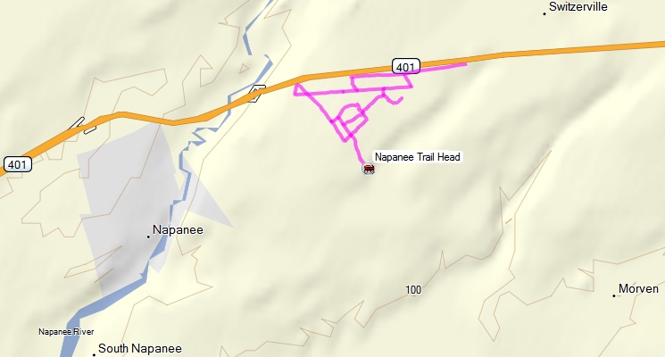
Trail Maps:
GPS:
No accuracy or fitness for any use claimed. Not to be used for navigation. Expect errors. May contain significant errors. Not endorsed by any authority or entity. Not to be used as a means of identifying legal trails. Always check with the local club or authority. Follow all official maps and signs, respect private property, and refrain from trespass. Abide by the saying - "If you don't know - don't go!"
| Talbot Trail ATV Club |
Trail Maps:
Other Ontario ATV Trail Associations / Locations
This section gathers together information that either doesn't fit under any of the categories previously discussed (e.g. trails that do not appear to be governed by any of the clubs or associations above) or that is repetitive of information given above, but under a different construct or organization. For example, the Bruce County Trails Network is a stand-alone organization under whom the Bruce County Rail Trail falls, but the Bruce County Rail Trail also falls under the Huron Shores ATV Club under the EOTA. I know - it's confusing as heck - which incidentally is one of the major problems facing ATVers in Ontario at this time - it can be incredibly confusing to try and sort out exactly where and when you can ride and what permission / membership / trail pass you need to do so.
Ontario Trails Council
Ontario Trails Council website
The Ontario Trails Council is a provincial multi-use trail organization. They maintain their own website which includes a listing of ATV trails and an Ontario ATV Trails Map.
As far as I can tell, they do not however have a membership or unified trail pass system for ATV trails listed under the Ontario Trails Council. Once again, this simply adds to the confusion that confronts the Ontario ATV rider. Some of the trails in the list / on the map have previously been discussed and fall under the governance of one of the organizations above - that is to say, in order to ride these trails you would need the appropriate Trail Pass indicated above. These "repeat" trails listed under the Ontario Trails Council but also governed by a previously described ATV association / club include:
| TRAIL NAME | REGION | CLOSEST TOWN | ATV Association / Club Governing (i.e. Trail Pass required) |
| Bruce County Rail Trail | Bruce-Grey | Port Elgin | EOTA / Huron Shores ATV Club |
| CP Trail | Headwater |
Flesherton | OFATV / Dufferin Grey ATV Club |
| Haliburton County Rail Trail | The Highlands | Haliburton | ATVO / Haliburton ATV Association |
| Victoria Rail Trail | Kawartha's | Lindsay | KATVA |
| Hastings Heritage Trail | Quinte & Prince Edward Country | Glen Ross | EOTA |
| Kaladar Trail - Trans Canada Trail Section | Land O'Lakes | Kaladar | EOTA |
| Renfrew County ATV Club Inc. | Ottawa Valley | Barry's Bay | EOTA / Renfrew County ATV Club |
| JR Booth Trail | Rainbow Country | Edgington | ATVO / Parry Sound Node |
| Park-to-Park Trail | Algonquin Park Region | Parry Sound | ATVO / Parry Sound Node |
| Seguin Recreational Trail | Rainbow Country | Parry Sound | ATVO / Parry Sound Node |
The remainder of the trails listed as ATV trails on the Ontario Trails Council website do not, so far as I can tell, have a clear and obvious ATV Association governing them. To be clear, this does not mean they are not governed by an ATV club or association - just that it isn't clear who if anyone does, and by extension, whose Trail Pass is required to ride them. In several cases, trails listed in the table below fall in a region that does have a governing ATV association and/or club, so it's possible they are governed by that association/club but I am unable to find any information online that confirms this. This is usually due to the fact that the associations / clubs in question do not provide maps, coordinates, or detailed trail descriptions online with which I can match the trails below. Once again, this is part of the ridiculous confusion that confronts the average Ontario ATV rider.
For the trails in these two tables, if I have been able to find any other information or maps online the data appears below.
| TRAIL NAME | SUB-REGION | CLOSEST TOWN | ATV Association / Club Governing (i.e. Trail Pass required) |
| Ganaraska Forest | Kawartha's | Kendal | Unknown (Ganaraska Forest have their own permits - see below) |
| IB & O Rail Trail | Algonquin Park Region | Oxtongue Lake | Unknown - Possibly ATVO / Haliburton ATV Association |
| Tiny Trail | Lake Simcoe | Township of Tiny | Unknown - Possibly OFATV / Central Ontario ATV Club |
| Thomas P. Murray Recreational Trails | Ottawa Valley | Barry's Bay | Unknown - Possibly EOTA / Renfrew County ATV Club |
| Ahmic Lake Trail | Near North | Ahmic Harbour | Unknown |
| Old Nipissing Road | Near North | Magnetawan | Discovery Routes / Crown Land |
Ganaraska Forest
Description:
Portions of the Ganaraska Forest (the West Forest and East Forest areas) permit ATV use in certain areas.
Ganaraska Forest is the only legally designated ATV trail system in Durham Region.
Trail maps and permits are available from the Forest Centre located at:
Ganaraska Forest Centre
10585 Cold Springs Camp Road
Campbellcroft, Ontario
The red P's and small pink squiggle near the centre of this map illustrates the location of Ganaraska Forest:
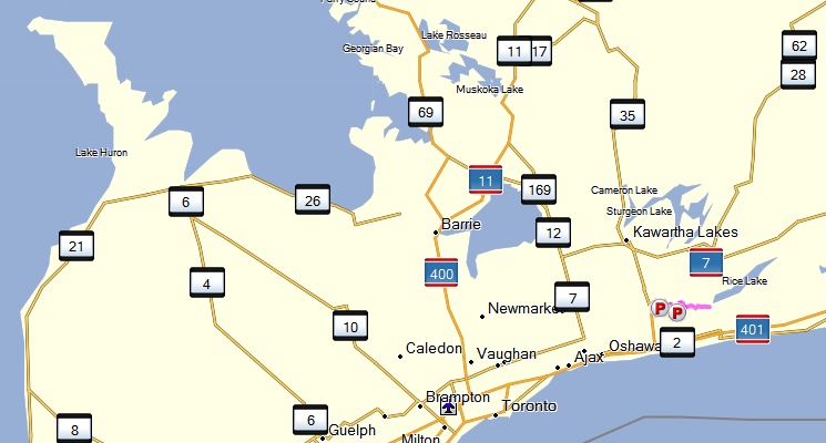
This pic illustrates the Ganaraska Forest trails where ATV use is permitted:
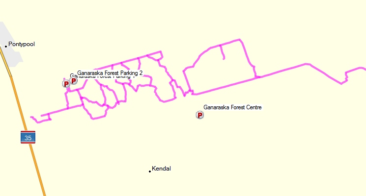
Trail Passes / Membership:
According to the Ganaraska Forest user-fee web page
For further information on the Ganaraska Forest call the Forest Centre at 905-797-2721 or visit the Ganaraska Region Conservation Authority website at www.grca.on.caATV day passes are $25 for adults and $10 for youth
Annual memberships are $125 for adults and $60 for youth
Annual permits and day use permits are available at:
- Ganaraska Forest Center (Cold Springs Camp Road)
905 797-2721- Ganaraska Main Office (2216 County Road 28)
905 885-8173- Ganaraska Leathercraft (Wilcox Road)
905 983-9540- Noone's Petro Canada (Hwy25/115 N of Kirby)
905 983-9290
Trails:
Trail Maps:
GPS:
No accuracy or fitness for any use claimed. Not to be used for navigation. Expect errors. May contain significant errors. Not endorsed by any authority or entity. Not to be used as a means of identifying legal trails. Always check with the local club or authority. Follow all official maps and signs, respect private property, and refrain from trespass. Abide by the saying - "If you don't know - don't go!"
Rules & Regulations:
See:
Durham Region ATV Safety Coalition
Durham Region ATV Safety Coalition ATV Safety Brochure (Alternate PDF file download)
IB & O Rail Trail
Description:
There are two starting points for this trail. The trailhead for the entire trail is at the intersection of County Road 4 (Essonville Line) and Farr Road (formally Otter Lake Road). The second trailhead is 5 km down the trail and can be accessed from Highway 118 at Tory Hill. This trailhead gives you the option to hike north towards the original trailhead (5 km) or south towards County Road 503 (8 km).
The red P's near the centre of this map illustrates the location of the IB & O Rail Trail:
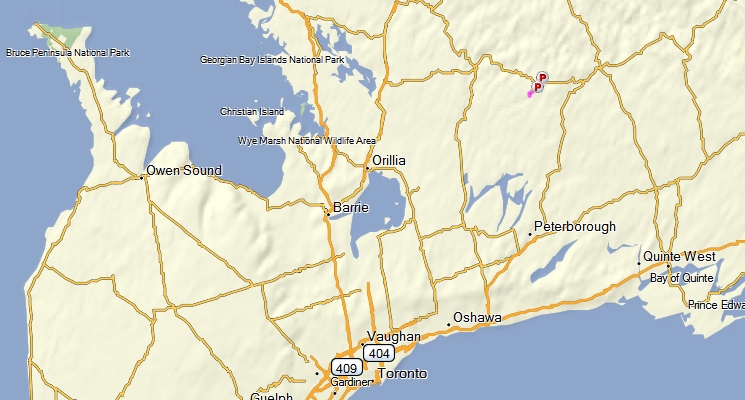
This pic illustrates the IB & O Rail Trail:
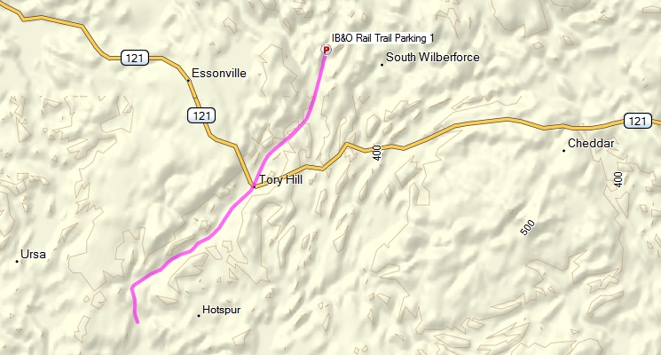
Trail Passes / Membership:
Unknown - Possibly falls under Haliburton ATV Association
Trail:
Trail Maps:
GPS:
No accuracy or fitness for any use claimed. Not to be used for navigation. Expect errors. May contain significant errors. Not endorsed by any authority or entity. Not to be used as a means of identifying legal trails. Always check with the local club or authority. Follow all official maps and signs, respect private property, and refrain from trespass. Abide by the saying - "If you don't know - don't go!"
Tiny Trail Rail Trail
Description:
The 22.5 km abandoned railway right of way located in the Township of Tiny, County of Simcoe has its southern terminus at the Tiny/Flos (Springwater) line 1.5 km north of Elmvale. It runs roughly north, parallel to County Road 6, one of the main north-south arteries of the Township and then angles northeastward to its north terminus at the southern town limits of Penetanguishene.
The red P's near the centre of this map illustrates the location of the Tiny Trail Rail Trail:
This pic illustrates the Tiny Trail Rail Trail:
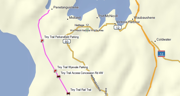
Trail Passes / Membership:
Unknown - Possibly falls under OFATV / Central Ontario ATV Club
Trail:
Trail Maps:
Ontario Trails Council Web Page
Downloadable PDF
Alternate Downloadable PDF
GPS:
No accuracy or fitness for any use claimed. Not to be used for navigation. Expect errors. May contain significant errors. Not endorsed by any authority or entity. Not to be used as a means of identifying legal trails. Always check with the local club or authority. Follow all official maps and signs, respect private property, and refrain from trespass. Abide by the saying - "If you don't know - don't go!"
Hastings Heritage Trail
Description:
The Hastings Heritage Trail is a four-seasons, multi-use recreational trail that follows an old railway line linking Hastings County. The Trail is open year-round and boasts a number of parking lots and access points along the route. It welcomes hikers, cyclists, horseback riders, and recreational vehicle operators. Trails in Hastings County consist of a 156-km ribbon of land stretching from Glen Ross to Lake St. Peter, connecting them to the waterways of the Trent Canal System in the south and the edge of Algonquin Park in the north. Within the right-of-way of the Hastings Heritage Trail are waterfalls, wetlands, and relics of ghost towns like Brinklow. Within sight of the trail are historical buildings like Hogan's Hotel, built in 1862, and other significant trances of the builders of the rail line. Information provided by the Central Ontario Loop Website.
The pink line near the right edge of this map illustrates the location of the Hastings Heritage Trail:
This pic illustrates the Hastings Heritage Trail:
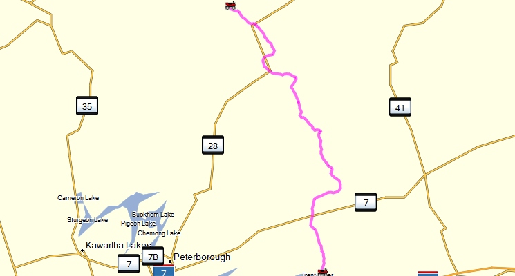
Trail Passes / Membership:
EOTA (Appears on EOTA map (unknown club affiliation))
Trail:
Trail Maps:
GPS:
No accuracy or fitness for any use claimed. Not to be used for navigation. Expect errors. May contain significant errors. Not endorsed by any authority or entity. Not to be used as a means of identifying legal trails. Always check with the local club or authority. Follow all official maps and signs, respect private property, and refrain from trespass. Abide by the saying - "If you don't know - don't go!"
Kaladar Trail (Trans Canada Trail - Kaladar Section)
Description:
Kaladar is a community in Lennox and Addington County in eastern Ontario. It is located at the junction of Highway 7 and Highway 41.
This part of the Trans Canada is part of Eastern Ontario Trail Alliance and there is user pay. It is part of CP rail corridor, links westerly to Tweed and Havelock and easterly to Sharbot Lake and Glen Tay. This is a tourist area being part of the Land of Lakes Region.
The pink line near the right edge of this map illustrates the location of the Kaladar Trail:
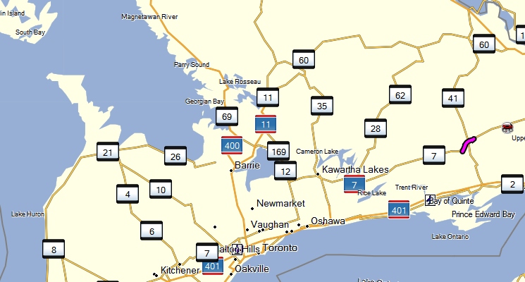
This pic illustrates the Kaladar Trail:
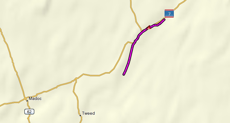
Trail Passes / Membership:
EOTA
Trail:
Trail Maps:
GPS:
No accuracy or fitness for any use claimed. Not to be used for navigation. Expect errors. May contain significant errors. Not endorsed by any authority or entity. Not to be used as a means of identifying legal trails. Always check with the local club or authority. Follow all official maps and signs, respect private property, and refrain from trespass. Abide by the saying - "If you don't know - don't go!"
Renfrew County ATV Club Inc.
(see entry under EOTA)
Thomas P. Murray Recreational Trails
Description:
Situated in and amongst Barry's Bay Ontario are the Thomas P. Murray Recreational Trails. This combination of trails represents a variety of trail uses within a geographic area. A combination system of at least 6 trails this varied use provides the option for multiple activity within a day!
The trails made up of the following - the Crooked Slide Trail - Extending from the area’s famous and picturesque park to McGillivray Trail and Lookout, this trail can be easily hiked/walked. Length: 1.25 km
Drohan’s Trail - A challenging trail with a variety of terrain. Take note of the ponds, creeks and rock outcroppings along the route. Length: 4.5 km
Gun Mountain Trail - Climb the hill to the top of the mountain to enjoy the view from Tom’s Lookout. Varied terrain and steep inclines. Length: 1.7 km
McGillivray Trail & Lookout - Our most difficult trail featuring very steep hills. Also one of our most beautiful lookouts. An alternate, easier route to the lookout can be found south of Long Lake Rd, along an active logging road. Length: 3.5 km
Red Pine Trail - An easy to moderate trail, extending to the base of Tom’s Lookout. Length: 4.2 km
Tom’s Trail - Now open! Enjoy this trek along a scenic beaver pond. Length: 2 km
The red P's in the top right corner of this map illustrates the location of the Thomas P. Murray Recreational Trails:
This pic illustrates the Thomas P. Murray Recreational Trails:
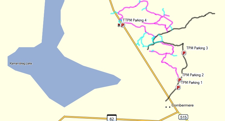
Trail Passes / Membership:
Unknown - Possibly EOTA / Renfrew County ATV Club
Trail:
Trail Maps:
GPS:
No accuracy or fitness for any use claimed. Not to be used for navigation. Expect errors. May contain significant errors. Not endorsed by any authority or entity. Not to be used as a means of identifying legal trails. Always check with the local club or authority. Follow all official maps and signs, respect private property, and refrain from trespass. Abide by the saying - "If you don't know - don't go!"
Discovery Routes Trails Organization
Discovery Routes is another trail organization, whose website includes two of the trails that also appear on the Ontario Trails Council website: the Ahmic Lake Trail and the Old Nippising Road, along with a third ATV trail called the Callander section of the Trans Canada Trail.
Discovery Routes Trails Organization was established in 1992. As a not-for-profit organization as well as a registered charity, Discovery Routes’ main responsibilities are to create, maintain, and promote multi-seasonal trails in the Near North region of Ontario. Discovery Routes is a volunteer partnership of community leaders, economic developers, environmental stewards and locally-based action groups. We promote the use of trails in support of better health, tourism, strong communities, and environmental appreciation and protection. One of Discovery Routes’ main goals is to provide the coordination for community based partnerships to actively promote the use of local trails for recreation, and to encourage healthy lifestyles. Discovery Routes’ region includes the area from Mattawa to West Nipissing, and from Magnetawan north to Marten River.
Mission Statement:
To facilitate and manage the development, maintenance, and promotion of the region’s recreational trails systems, and encourage the use of trails to improve one’s health and well being while enjoying the natural beauty and history of Ontario’s Near North.
Trail Passes / Membership:
Discovery Routes Membership Web Page
As far as I can tell, the Discovery Routes organization doesn't have a Trail Pass system like the other organizations, but they do sell memberships. According to their website:
This membership will give you:
- Notice of trail events and trail openings across the region
- Stay up-to-date with our digital newsletter – Trail Tales
- Have your say by voting at the Annual General Meeting
- Help improve the quality of community life
Individual Membership
- $12 for 12 months (Individual)
- $24 for 12 months (Family)
However, it is not clear that purchasing a membership is required for riding the trails. Details on purchasing a membership are available on the Discovery Routes Membership Web Page.
Trails:
The Discovery Routes online interactive trail map contains mostly just icons in the general area of each trail, most of which are hiking trails, and those tracks that are on the website can be inaccurate. Accordingly, I have summarized data for the three ATV trails below.
Callander section of the Trans Canada Trail
Description:
Discovery Routes developed a 9.8 km section of the Trans Canada Trail in the southwest corner of the Municipality of Callander.
The trail winds up and down through terrain that is characteristic of the region’s landscape. Wildlife is abundant on this remote trail as it passes through numerous habitat types. At the western reaches, the trail crosses through active farmlands where cattle might be spotted amongst the trees.
Muddy conditions should be expected in the early spring and during episodes of wet weather. Secondary hiking trails have been developed around the wet areas offering an alternative to wet feet.
During the winter months, much of the trail is under the management of the South Shore/ Restoule Snowmobile Club and the OFSC.
The red ATV icon on this map illustrates the location of the Callander section of the Trans Canada Trail:
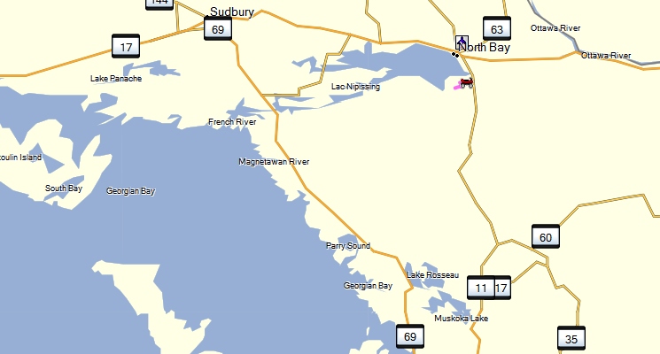
This pic illustrates the Callander section of the Trans Canada Trail:
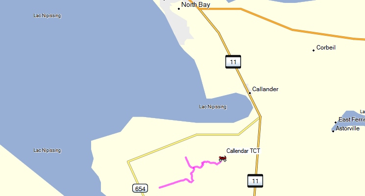
Trail Passes / Membership:
Unknown
Trail:
Trail Maps:
GPS:
No accuracy or fitness for any use claimed. Not to be used for navigation. Expect errors. May contain significant errors. Not endorsed by any authority or entity. Not to be used as a means of identifying legal trails. Always check with the local club or authority. Follow all official maps and signs, respect private property, and refrain from trespass. Abide by the saying - "If you don't know - don't go!"
Ahmic Lake Trail
Description:
From Ahmic Harbour, head southeast along the Ahmic Lake Road past the narrows of Neighick and Crawford Lakes. Follow trail signs until you meet up with the Old Nipissing “Ghost Road” at Spence. Head north (left) past the Spence cemetery; enjoy the scenery of Ahmic Lake along the way. At Magnetawan, take in the historical sites, catch a swim and head out of town northwest on Hwy 20 to Hwy 124 west.
This short portion of the highway skirts Whalley Lake then passes Knoepfli Falls where Ahmic Lake drops back into the Magnetawan River. Make sure you stop at the Knoepfli Falls with your camera or sketchbook. A little further along, Fagan Falls also drops into the Magnetawan River just before the Village of Ahmic Harbour.
The pink lines near the top-centre of this map illustrates the location of Ahmic Lake Trail:
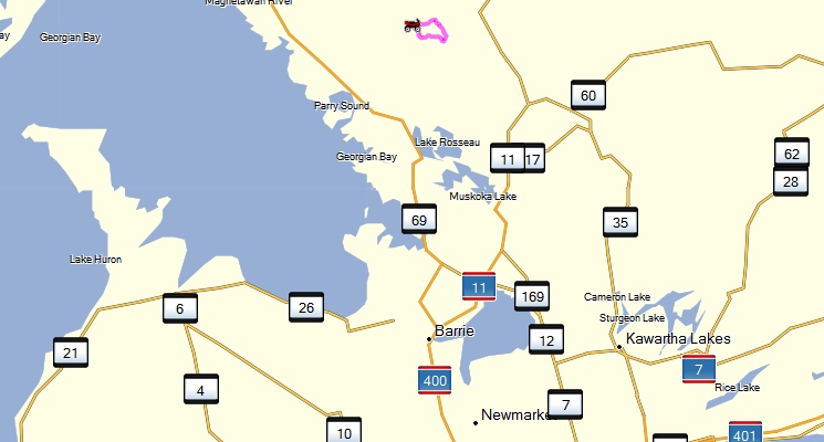
This pic illustrates the Ahmic Lake Trail:
Trail Passes / Membership:
Unknown
Trail:
Trail Maps:
GPS:
No accuracy or fitness for any use claimed. Not to be used for navigation. Expect errors. May contain significant errors. Not endorsed by any authority or entity. Not to be used as a means of identifying legal trails. Always check with the local club or authority. Follow all official maps and signs, respect private property, and refrain from trespass. Abide by the saying - "If you don't know - don't go!"
Old Nippising Road
Description:
The Nipissing Road was once home to many settlements of hopeful pioneers, but is now guarded by their abandoned log cabins and weathered barns. The road runs through the centre of the Parry Sound District between highways 69 and 11. It winds along 70 km of gravel road, bush trail and paved highway (#510) from Rosseau on Hwy 141 to Nipissing on Hwy 534. The Nipissing Road is a ghost town trail with no facilities between Magnetawan and Nipissing. Although the road is gravel, its condition varies. Some sections are wide and well kept; others are little more than two ruts plunging into dark woods, much as the pioneers might remember it. A series of historic markers are located along the route.
Once a colonization road to early settlers, and now part of the Trans Canada Trail, the Old Nipissing Road tells stories of hope, hardship, perseverance, and despair. Seguin Falls, Dufferin Bridge, Spence, and Magnetawan, are only some of the original settlements along the southern portion of the trail, most of which are camouflaged and overgrown by nature and time.
Magnetawan, mid-way along the trail, is the only thriving village on the 'ghost road' today, and offers the visitor food, fuel, lodging, historical points of interest, water sports, hiking trails, picnic sites, and leisure activities.
The pink line near the top-centre of this map illustrates the location of the Old Nippising Road:
This pic illustrates the Old Nippising Road trail:
Trail Passes / Membership:
Unknown - Possibly Crown Land
Trail:
Trail Maps:
GPS:
No accuracy or fitness for any use claimed. Not to be used for navigation. Expect errors. May contain significant errors. Not endorsed by any authority or entity. Not to be used as a means of identifying legal trails. Always check with the local club or authority. Follow all official maps and signs, respect private property, and refrain from trespass. Abide by the saying - "If you don't know - don't go!"
Trillium Trail Network
Trillium Trail Network Website
For the sake of completeness, and at the risk of complicating things (more than they already are) it is necessary to mention the Trillium Trail Network as you may come across the name. The Trillium Trail Network (TTN) is a network of trails of the Ontario Trails Council (OTC). According to the TTN website:
The Ontario Trails Council promotes the development of trails. One method that is popular is the linear and loop trail concept. That is, as you use a trail, you are actually using a section that's part of a larger connected system of trails. In Ontario we call this the Trillium Trail Network (TTN).The Trillium Trail Network (TTN) represents an opportunity for trails to link together between regions and communities in Ontario. The TTN consists of OTC member trails registering their trail as a network member.
As you may recall when we looked at the trails listed on the OTC website, most were governed by a Trail Pass system issued by one of the "Big 3" ATV associations in Ontario, such as the Eastern Ontario Trails Alliance (EOTA), with a few unknowns as well.
The TTN appears as if it is or was an effort by the OTC to group trails of the OTC together into a single network of trails with a trail pass system. The Trillium Trail Network Website makes reference to such a pass where it says:
The OTC's Trillium Trail Network Business Plan has been developed to provide trail user, trail management support through products and services that support trails. In this way trail users and trail operators can self-fund their own sustainability! One way is to sell the Trillium Trail Permit.
However, there is no current information on this Trillium Trail Permit. A web search turned up a PDF document online (alternate PDF download) dating from 2008 that seems to indicate that a pass called the Trillium Trail Network Gold Trail Permit either existed at that time or was contemplated. Another PDF document online (alternate PDF download), also dating from 2008, gives a pricing structure for something called the "Trillium Trail Gold Permit". Interestingly, the pricing is the same as for the previously discussed OFATV and EOTA Trail Pass, namely: $140 annually / $75weekly / $20 daily. At the very bottom of the document it states:
For information on specific TTN Gold Trail rides, permits and lists of permit re-sellers contact the
Eastern Ontario Trails Alliance -1-613-478-1444 or the Ontario Federation of All-Terrain Vehicle
Clubs 1- 705-797-0797.
So, from this, I conclude that the current OFATV / EOTA Trail Pass has taken the place of the "Trillium Trail Gold Permit". I base this conclusion on the fact that:
There appears to be no current information on purchasing something called a "Trillium Trail Gold Permit".
What information there is is dated, and refers you to the OFATV / EOTA.
I can find no information anywhere on any trail requiring a TTN Trail Permit, and in fact the only mention I can find of it anywhere in my research has been the Kawartha ATV Association Trail Permits web page: stating that a TTN Trail Permit is not recognized or accepted for their trails, as follows:
The following ATV Permits/Passes ARE NOT VALID in our riding area of the City of Kawartha Lakes:
- Trillium Trail Pass,
- OFATV Pass,
- EOTA Pass,
- ATVOntario PowerPass
Bruce County Trail Network
Bruce County Trail Network WebsiteThe Bruce County Trail Network is yet another trail organization in Ontario. According to their website:
Mission Statement
The Bruce County Trail Network will plan, advocate, educate, promote and partner in the development of a comprehensive regional trail system in Bruce County, providing a variety of trail building, trail use and trail event resources to trail organizations, individuals and municipalities within the County.
Vision
Development of a four-season regional trail system in Bruce County with links to trails beyond County borders.
There is currently only one ATV trail in the Bruce County Trail Network, the Bruce County Rail Trail. This trail falls under the stewardship of the Huron Shores ATV Club and an EOTA / OFATV Trail Pass is required to ride the Bruce County Rail Trail.
Bruce County Rail Trail
Description:
The Bruce County Rail Trail is approximately 80 kilometers in length. It runs from Port Elgin to the Bruce-Huron Line and from Port Elgin to Bruce Road 33 near Kincardine. The trail has been signed and gated and some upgrades to the trail surface have been completed. Most of the rail trail surface is made up of a mixture of soil and coarse aggregate. Over the next few years the County of Bruce hopes to have the majority of the trail surfaced with stone dust and gravel. The Teeswater and Willow Creek Trestle Bridges in the Paisley area were refurbished in the fall of 2009. These bridges give users an excellent viewing platform of the rivers and valleys surrounding Paisley.
The red P's near the centre of this map illustrates the location of the Bruce County Rail Trail:
This pic illustrates the Bruce County Rail Trail:
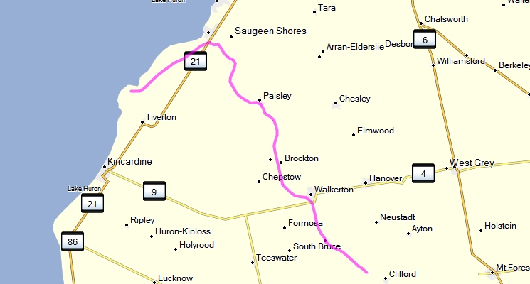
Trail Passes / Membership:
EOTA / OFATV - falls under Huron Shores ATV Club
Trail:
Trail Maps:
GPS:
No accuracy or fitness for any use claimed. Not to be used for navigation. Expect errors. May contain significant errors. Not endorsed by any authority or entity. Not to be used as a means of identifying legal trails. Always check with the local club or authority. Follow all official maps and signs, respect private property, and refrain from trespass. Abide by the saying - "If you don't know - don't go!"
Limerick Forest
Where to Ride:
Limerick Forest is a 5782-hectare community forest located in eastern Ontario, owned and managed by the United Counties of Leeds and Grenville.
Trail maps posted on the information kiosks, available on the Limerick Forest website, and also available below illustrate suitable uses for a specific trail, i.e., "multi-use double track" and "truck/car" for ATVs ATVs are not permitted (nor would they fit) on trails marked "single track".
The red P's near the right-centre of this map illustrate the location of the Limerick Forest:
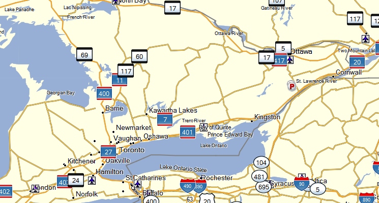
The following pic illustrates the general area of Limerick Forest and the three areas for which separate trail maps are available (below):
Trail Passes / Membership:
Use of ATVs in Limerick Forest is permitted providing all Federal and Provincial legal requirements are adhered to.
Rules / Restrictions / Policies:
The following regulations apply when operating on Limerick Forest property:
- Motorized vehicles must be registered with the Ministry of Transportation and display license plates as issued by a motor vehicle license office
- Motorized vehicles must be covered by liability insurance. The driver of the vehicle must carry proof of insurance.
- Operators of off-road vehicles require the permission of land owners to ride on all trails and on private land, including those shown as snowmobile trails on the forest map
- Motorized vehicles are to use only existing trails.
- Motorized vehicles must not exceed 50 km per hour.
- Motorcycles and off-road vehicles (any two
or more wheeled vehicle designed primarily
for recreational use) must comply with noise
limits and standards as set by the Canadian Motorcycle Association.
Code Of Conduct
- Do not trespass on private property.
- Ride on existing trails.
- Respect nature.
- Respect and be courteous to other people who also have the right to be on the trails.
- Remember that few other vehicles are as maneuverable as bikes, so give the others lots of room.
- Hunt camp owners do a lot of trail grooming. Respect their efforts.
- Stop when you see a horse. Shut down.
- Comply with all legislation, bylaws and insurance requirements.
- Always wear a helmet and other safety gear.
- Do not litter.
- Leave the place better than you found it.
- Keep your machine QUIET. More sound = less ground!
Trails:
Trail Maps:
Limerick Forest Overall Area Map (Alternate PDF download)
Limerick Forest Area 1 (Alternate PDF download)
Limerick Forest Area 1 with Satellite Imagery (Alternate PDF download)
Limerick Forest Area 2 (Alternate PDF download)
Limerick Forest Area 2 with Satellite Imagery (Alternate PDF download)
Limerick Forest Area 3 (Alternate PDF download)
Limerick Forest Area 3 with Satellite Imagery (Alternate PDF download)
GPS:
No accuracy or fitness for any use claimed. Not to be used for navigation. Expect errors. May contain significant errors. Not endorsed by any authority or entity. Not to be used as a means of identifying legal trails. Always check with the local club or authority. Follow all official maps and signs, respect private property, and refrain from trespass. Abide by the saying - "If you don't know - don't go!"
Section 5 - Municipal By-Laws.
Click Here to open a new page with a listing of and links to Ontario Municipal By-Laws covering ATV use on-road.
Section 6 - Other Organizations.
The following organizations are those that are related to or impact ATV riding but that do not administer, maintain, or govern trails directly.
All Terrain Quad Council of Canada (AQCC)
All Terrain Quad Council of Canada WebsiteVision
AQCC is a united group that is composed of provincial / Territorial Federations or Associations across Canada that represents ATVers best interests. It creates in itself a national body to work on the establishment of a national trail systems that will link all jurisdictions in Canada. It’s also a resource for member organizations to corroborate their efforts to overcome obstacles. AQCC is the national voice that will speak to various Governments or partner organizations on behalf of ATV enthusiasts.Mission
The AQCC has a clear mission, it will work on 5 major components safety, land access, land management, environmental concerns along with a long term funding plan. AQCC is also proactive by promoting ATVing as fun sport that can be enjoyed with friends and or family members while adhering to a code of ethics.Mandate
The AQCC mandate is to improve and develop the sport of All Terrain Vehicle / Quad riding nationally by providing a strong support to it member organizations
Canadian AQCC Safety Institute (CASI)
Canadian AQCC Safety Institute Website
The Canadian AQCC Safety Institute (CASI) - a division of the All-Terrain Quad Council of Canada (AQCC) - has joined forces with the ATV Safety Institute (ASI) and the Canadian Off-Highway Vehicle Distributors Council (COHV) to offer CASI’s new ATV Rider courses.
The hands-on, half-day CASI ATV Rider courses is conducted by licensed CASI Instructors. The course offers students an opportunity to increase their safety knowledge and to practice basic riding skills in a controlled environment under the direct supervision of a licensed Instructor.
Canadian Off-Highway Vehicle Distributors Council (COHV)
Canadian Off-Highway Vehicle Distributors Council Website
COHV has introduced, the booklet Parents, Youngsters and All-Terrain Vehicles (link to PDF) that is intended to assist parents in determining if your youngster is ready to ride all-terrain vehicles (ATVs). It also provides important safety information and tips on learning to ride.
COHV Safe Rider Code
- Know Your Operator's Manual
- Check the ATV Before You Ride
- Wear Your Helmet
- Protect Your Eyes and Body
- Get Qualified Training
- Ride Off-Road Only, Never on Public Roads
- Ride With Others – Never Alone
- Ride Within Your Skills
- Carry No Passengers
- Respect Riding Area Rules
- Keep Noise Levels Low
- Ride Straight – No Alcohol or Other Drugs
- Preserve the Environment
- Be Courteous to All You Meet
- Lend Your ATV to Skilled Riders Only
- Always Supervise Youngsters
Canadian All-Terrain Vehicle Distributors Council VOLUNTARY STANDARD FOR 4-WHEEL ALL-TERRAIN VEHICLES (Alternate PDF file)
National Off Highway Vehicle Conservation Council
National Off Highway Vehicle Conservation Council Website
The National Off Highway Vehicle Conservation Council is an American 501(c)3 education non-profit organization. According to their website:
We are not a membership organization, but rather a partnership organization. We have volunteer State and Associate State Partners in almost all of the United States. We are working to get all of the states covered. We also have a Partnership with the All Terrain Quad Council of Canada and the Motorcyclists Confederation of Canada. In addition to these enthusiast partnerships, we have and form partnerships with government agencies such as the US Forest Service, the BLM, the Federal Highway Administration, plus State and Local agencies.
Our goal, simply, is to provide 'A Positive Future for OHV Recreation'.
Vision
OHV recreation is a nationally accepted outdoor activity and quality opportunities are readily available to all who wish to participate responsibly.
Values
We value OHV Recreation as a means to provide:
- Quality family and social time;
- Healthy, physical outdoor activity for a broad range of ages, physical abilities and interests;
- Experiences that promote a responsible life style;
- Enjoyment of and appreciation for natural and cultural resources;
- and Relief from the pressures of daily life.
Mission
NOHVCC, as a national body of OHV recreation enthusiasts, develops and provides a wide spectrum of programs, materials and information, or “tools”, to individuals, clubs, associations and agencies in order to further a positive future for responsible OHV recreation.
Mission Objectives:
- Help establish new OHV clubs and state associations where they don’t exist;
- Strengthen existing clubs and state associations by providing information, training and services to help them be more effective;
- Improve and promote responsible OHV recreation management and resource protection by working in partnership with private and public land managers and recreation planners;
- Provide and promote best management practices for OHV recreation planning, development and management to policy makers;
- Promote a positive OHV recreation image to all publics;
- Build a better understanding of responsible OHV recreation among all publics;
- Build recognition and acceptance that OHV recreation is a positive activity and promotes a responsible life style;
- Provide broad-based, ongoing educational opportunities for OHV recreationists, recreation planners and decision-makers; Provide and promote educational, safety, ethics, environmental and character-building programs for all OHV recreationists including youth; and
- Emphasize the benefits of responsible recreation behavior and raise awareness of the impacts from irresponsible recreation activity.
Canadian Trails Federation (CTF)
Canadian Trails Federation Website
The Canadian Trails Federation was incorporated federally in 2002. Its mission is to enhance the recreational trails network in Canada by sharing information; providing leadership and coordination; and building national and international consensus within the Canadian trails community.
The National Trails Coalition (NTC)
The National Trails Coalition Website
The National Trails Coalition (NTC) is the operating name for the Coalition of Canadian Trails Organizations, a federally incorporated not-for-profit organization. The NTC was formed in 2007 to bring the broad spectrum of trail-based activities together in a collaborative manner to build, maintain and promote trails and trail use across Canada. One of the founding principles of the Coalition is building new partnerships between trail disciplines; fostering more multiple-use trail development; and providing a trail-based platform on which private enterprise and volunteer groups alike can generate economic activity.
Specialty Vehicle Institute of America
Specialty Vehicle Institute of America Website
The Specialty Vehicle Institute of America (SVIA) is an information source about the all-terrain vehicle (ATV) industry. SVIA provides information on ATV standards and promotes model state legislation on ATV riding. It also serves as a liaison with state and federal agencies on ATV rider safety issues and ATV training courses.
SVIA was formed in 1983 as a national not-for-profit trade association and is based in Irvine, California.
SVIA is the American National Standards Institute (ANSI) accredited standard developer for the ANSI 4-wheeled ATV standard.
Discover Today's All-Terrain Vehicles (DTA)
Discover Today's All-Terrain Vehicles Website
Discover Today's All-Terrain Vehicles (DTA) is the communications service bureau of the Specialty Vehicle Institute of America (SVIA). DTA provides information on and access to: industry experts, special users, safety and training, statistics and trends, and responsible use and environmental issues.
The All-Terrain Vehicle Safety Institute (ASI)
The All-Terrain Vehicle Safety Institute Website
The All-Terrain Vehicle Safety Institute (ASI), a not-for-profit division of the Specialty Vehicle Institute of America, was formed in 1988 to implement an expanded national program of ATV safety education and awareness. ASI’s primary goal is to promote the safe and responsible use of ATVs, thereby reducing accidents and injuries that may result from improper ATV operation by the rider.
Other Provincial ATV Federations
ATV Quad.ca web page listing provincial ATV Federations
BRITISH COLUMBIA
Quad Riders Association of British Columbia (ATV/BC)

atvbc@telus.net
www.atvbc.ca
#203-1139 12th Street
Kamloops, BC V2B 7Z2
1-866-766-7823
ALBERTA
Alberta Off Highway Vehicle Association (AOHVA)
info@aohva.com
www.aohva.com
500 Country Hills Blvd #725
Box 38017
Calgary, AB T3K 5G9
1-403 673-3332
SASKATCHEWAN
Saskatchewan All-Terrain Vehicle Association Inc (SATVA)

info@satva.ca
www.satva.ca
340 McCarthy Blvd.
PO
Box 31102, Normanview PO
Regina SK
S4R 8R6
1-855-29-SATVA (72882)
MANITOBA
All Terrain Vehicle Association of Manitoba (ATVMB)
info@atvmb.ca
www.atvmb.ca
Box 2494
Steinbach, MB
R5G 1N9
ONTARIO
Ontario Federation of All Terrain Vehicle Clubs (OFATV)
![]()
info@ofatv.org
www.ofatv.org
PO Box # 38
Ingersoll, ON
N5C 3K1
Telephone: (705) 797-0797
QUEBEC
Fédération Québécoise des Clubs Quads (FQCQ)

fqcq@fqcq.qc.ca
www.fqcq.qc.ca
6025 boul. Pie IX
Montréal, PQ, H1X 2C1
Telephone: (514) 252-3050
Fax: (514) 252-5280
NEW BRUNSWICK
New Brunswick All Terrain Vehicle Federation Inc.
nbatving@nb.aibn.com
www.nbatving.com
1925 Hanwell Rd. Unit C
Hanwell, NB E3C 1M4
Toll free: 1-888-847-1100
Tele: (506) 472-5130
Fax: (506) 472-5140
P.E.I.
PEI ATV Federation

info@peiatv.ca
P.O. Box 177
Tyne Valley, PE C0B 2C0
Phone: 902-831-2110
NOVA SCOTIA
All Terrain Vehicle Association of Nova Scotia (ATVANS)
![]()
execdirector@atvans.org
www.atvans.org
P.O. Box 46020 Novalea RPO
Halifax, NS B3K 5V8
Telephone (902) 727-2565 or 1-877-288-4244
NEWFOUNDLAND
Avalon Trailway Corporation (AVTRAC)
www.avtrac.ca
80 Fowler’s Road
Conception Bay South, NFLD A1W 4J3
(709) 834-1856 or (709) 697-1181
|
